ABKT Alibek, Turkmenistan - Earthquake Result Viewer
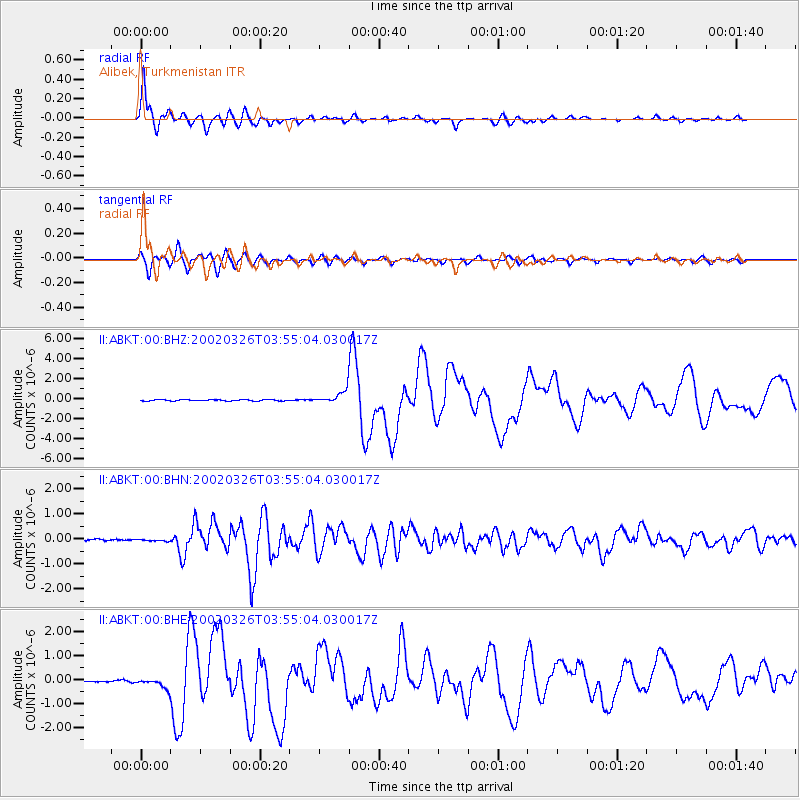
Earthquake location: Southwestern Ryukyu Isl., Japan
Earthquake latitude/longitude: 23.3/124.1
Earthquake time(UTC): 2002/03/26 (085) 03:45:48 GMT
Earthquake Depth: 33 km
Earthquake Magnitude: 5.8 MB, 6.6 MS, 6.4 MW, 6.4 MW
Earthquake Catalog/Contributor: WHDF/NEIC
Network: II Global Seismograph Network (GSN - IRIS/IDA)
Station: ABKT Alibek, Turkmenistan
Lat/Lon: 37.93 N/58.12 E
Elevation: 678 m
Distance: 57.5 deg
Az: 301.103 deg
Baz: 84.387 deg
Ray Param: 0.06338793
Estimated Moho Depth: 46.25 km
Estimated Crust Vp/Vs: 1.60
Assumed Crust Vp: 6.53 km/s
Estimated Crust Vs: 4.075 km/s
Estimated Crust Poisson's Ratio: 0.18
Radial Match: 97.01205 %
Radial Bump: 389
Transverse Match: 90.872 %
Transverse Bump: 400
SOD ConfigId: 20082
Insert Time: 2010-03-01 22:39:52.860 +0000
GWidth: 2.5
Max Bumps: 400
Tol: 0.001

Signal To Noise

ChannelStoNSTALTA
II:ABKT:00:BHN:20020326T03:55:04.030017Z0.85698773.89152E-84.5409287E-8
II:ABKT:00:BHE:20020326T03:55:04.030017Z5.6001072.1132557E-73.773599E-8
II:ABKT:00:BHZ:20020326T03:55:04.030017Z9.8076126.103754E-76.223486E-8
Arrivals
Ps4.5 SECOND
PpPs17 SECOND
PsPs/PpSs22 SECOND