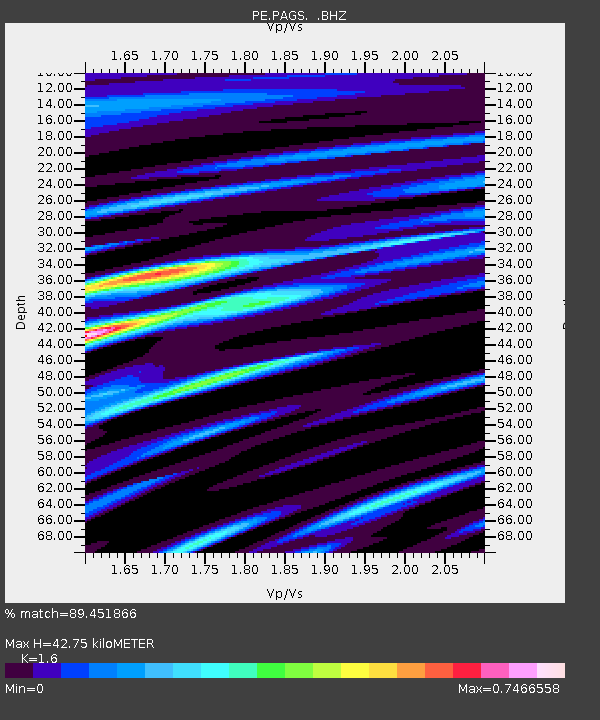
PAGS PA Geological Survey - Earthquake Result Viewer
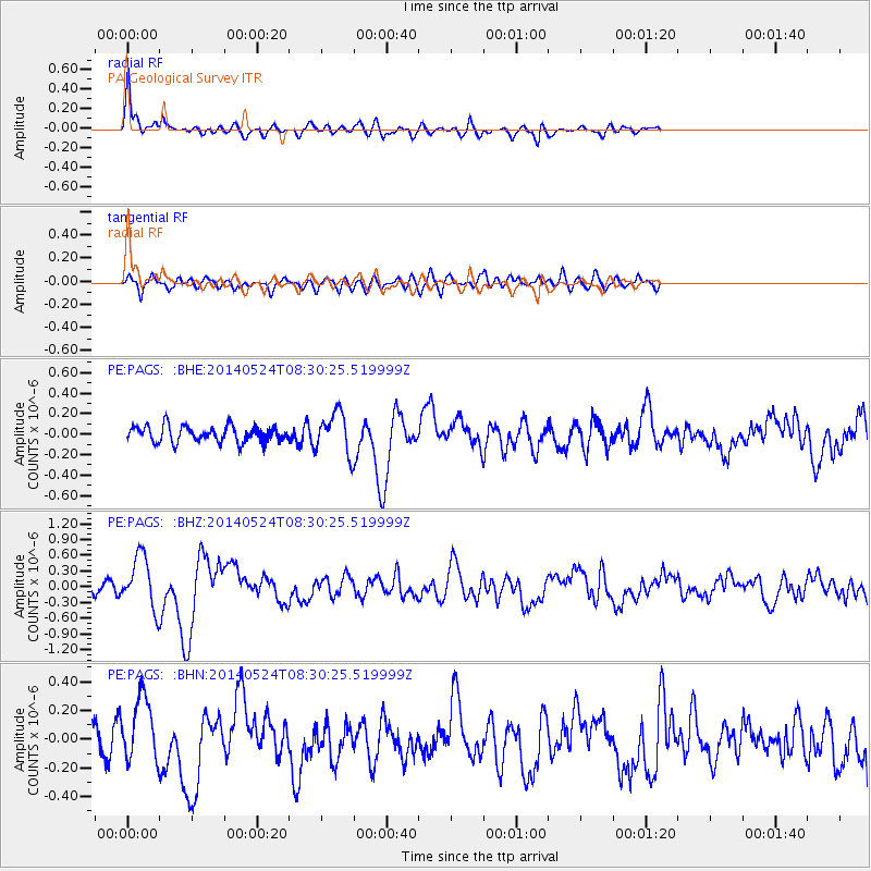
Earthquake location: Near Coast Of Guerrero, Mexico
Earthquake latitude/longitude: 16.5/-98.1
Earthquake time(UTC): 2014/05/24 (144) 08:24:47 GMT
Earthquake Depth: 17 km
Earthquake Magnitude: 5.7 MWW, 5.6 MWB, 5.7 MWC
Earthquake Catalog/Contributor: NEIC PDE/NEIC COMCAT
Network: PE Penn State Network
Station: PAGS PA Geological Survey
Lat/Lon: 40.23 N/76.72 W
Elevation: 120 m
Distance: 30.1 deg
Az: 33.932 deg
Baz: 224.376 deg
Ray Param: 0.07942348
Estimated Moho Depth: 42.75 km
Estimated Crust Vp/Vs: 1.60
Assumed Crust Vp: 6.121 km/s
Estimated Crust Vs: 3.825 km/s
Estimated Crust Poisson's Ratio: 0.18
Radial Match: 89.451866 %
Radial Bump: 400
Transverse Match: 60.69973 %
Transverse Bump: 400
SOD ConfigId: 626651
Insert Time: 2014-06-12 09:54:19.634 +0000
GWidth: 2.5
Max Bumps: 400
Tol: 0.001

Signal To Noise

ChannelStoNSTALTA
PE:PAGS: :BHZ:20140524T08:30:25.519999Z4.4924814.933611E-71.0981929E-7
PE:PAGS: :BHN:20140524T08:30:25.519999Z2.43716722.308192E-79.4707985E-8
PE:PAGS: :BHE:20140524T08:30:25.519999Z2.5797921.9923051E-77.7227355E-8
Arrivals
Ps4.5 SECOND
PpPs17 SECOND
PsPs/PpSs21 SECOND