You are here: Home > Network List > US - United States National Seismic Network Stations List
> Station DGMT Dagmar, Montana, USA > Earthquake Result Viewer
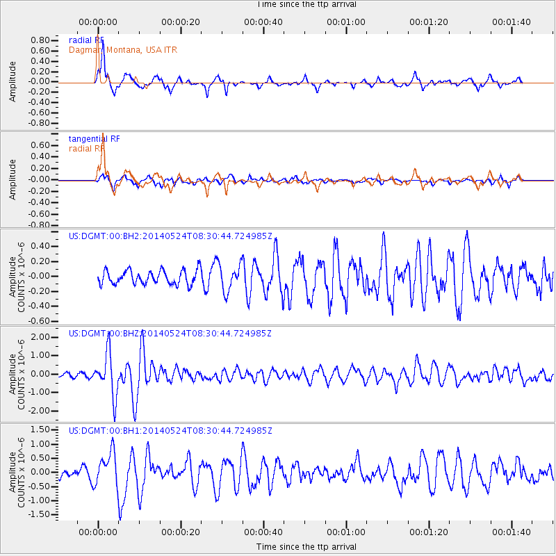
DGMT Dagmar, Montana, USA - Earthquake Result Viewer
*The percent match for this event was below the threshold and hence no stack was calculated.
| Earthquake location: |
Near Coast Of Guerrero, Mexico |
| Earthquake latitude/longitude: |
16.5/-98.1 |
| Earthquake time(UTC): |
2014/05/24 (144) 08:24:47 GMT |
| Earthquake Depth: |
17 km |
| Earthquake Magnitude: |
5.7 MWW, 5.6 MWB, 5.7 MWC |
| Earthquake Catalog/Contributor: |
NEIC PDE/NEIC COMCAT |
|
| Network: |
US United States National Seismic Network |
| Station: |
DGMT Dagmar, Montana, USA |
| Lat/Lon: |
48.47 N/104.20 W |
| Elevation: |
0.0 m |
|
| Distance: |
32.2 deg |
| Az: |
352.44 deg |
| Baz: |
169.069 deg |
| Ray Param: |
$rayparam |
*The percent match for this event was below the threshold and hence was not used in the summary stack. |
|
| Radial Match: |
85.38403 % |
| Radial Bump: |
400 |
| Transverse Match: |
70.08703 % |
| Transverse Bump: |
400 |
| SOD ConfigId: |
626651 |
| Insert Time: |
2014-06-12 10:08:16.446 +0000 |
| GWidth: |
2.5 |
| Max Bumps: |
400 |
| Tol: |
0.001 |
|
Signal To Noise
| Channel | StoN | STA | LTA |
| US:DGMT:00:BHZ:20140524T08:30:44.724985Z | 11.6074705 | 1.1922259E-6 | 1.02711944E-7 |
| US:DGMT:00:BH1:20140524T08:30:44.724985Z | 5.4778233 | 5.8935194E-7 | 1.0758871E-7 |
| US:DGMT:00:BH2:20140524T08:30:44.724985Z | 1.9220912 | 1.7806265E-7 | 9.264006E-8 |
| Arrivals |
| Ps | |
| PpPs | |
| PsPs/PpSs | |


