You are here: Home > Network List > UW - Pacific Northwest Regional Seismic Network Stations List
> Station LCCR Mulino, OR, USA > Earthquake Result Viewer
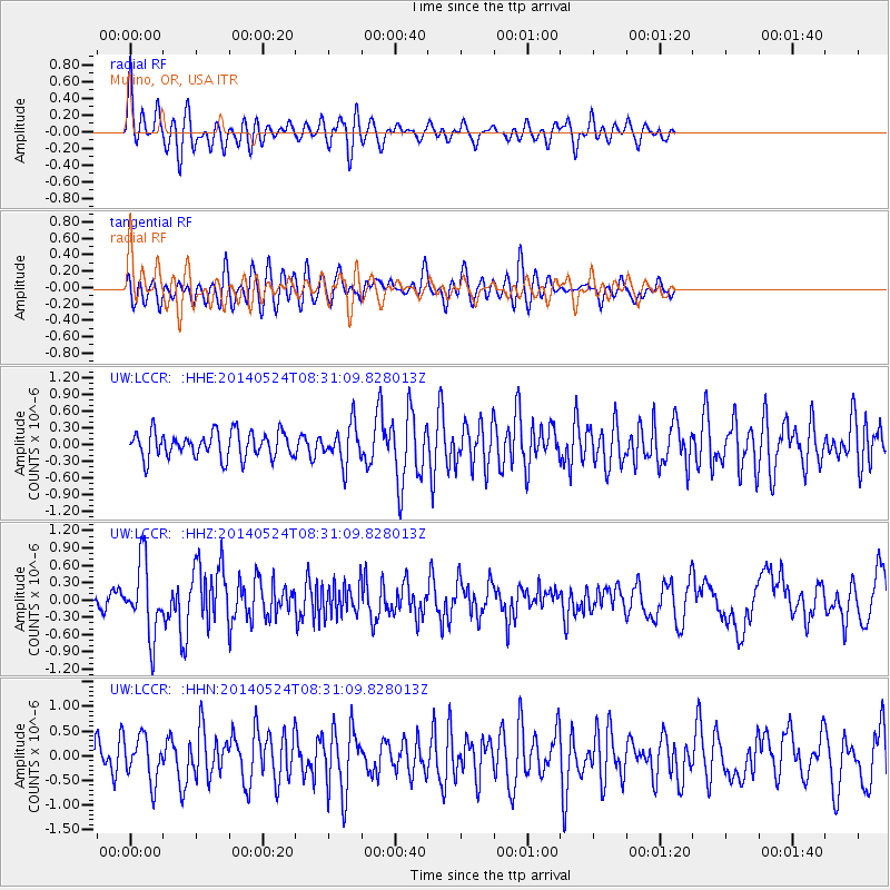
LCCR Mulino, OR, USA - Earthquake Result Viewer
*The percent match for this event was below the threshold and hence no stack was calculated.
| Earthquake location: |
Near Coast Of Guerrero, Mexico |
| Earthquake latitude/longitude: |
16.5/-98.1 |
| Earthquake time(UTC): |
2014/05/24 (144) 08:24:47 GMT |
| Earthquake Depth: |
17 km |
| Earthquake Magnitude: |
5.7 MWW, 5.6 MWB, 5.7 MWC |
| Earthquake Catalog/Contributor: |
NEIC PDE/NEIC COMCAT |
|
| Network: |
UW Pacific Northwest Regional Seismic Network |
| Station: |
LCCR Mulino, OR, USA |
| Lat/Lon: |
45.21 N/122.48 W |
| Elevation: |
273 m |
|
| Distance: |
35.1 deg |
| Az: |
329.588 deg |
| Baz: |
136.618 deg |
| Ray Param: |
$rayparam |
*The percent match for this event was below the threshold and hence was not used in the summary stack. |
|
| Radial Match: |
70.764915 % |
| Radial Bump: |
400 |
| Transverse Match: |
55.465107 % |
| Transverse Bump: |
400 |
| SOD ConfigId: |
626651 |
| Insert Time: |
2014-06-12 10:10:09.300 +0000 |
| GWidth: |
2.5 |
| Max Bumps: |
400 |
| Tol: |
0.001 |
|
Signal To Noise
| Channel | StoN | STA | LTA |
| UW:LCCR: :HHZ:20140524T08:31:09.828013Z | 4.8452663 | 6.215063E-7 | 1.2827081E-7 |
| UW:LCCR: :HHN:20140524T08:31:09.828013Z | 1.4754448 | 4.5005345E-7 | 3.05029E-7 |
| UW:LCCR: :HHE:20140524T08:31:09.828013Z | 1.5000204 | 3.464314E-7 | 2.3095113E-7 |
| Arrivals |
| Ps | |
| PpPs | |
| PsPs/PpSs | |


