You are here: Home > Network List > TA - USArray Transportable Network (new EarthScope stations) Stations List
> Station J04D Umpqua National Forest, Toketee, OR, USA > Earthquake Result Viewer
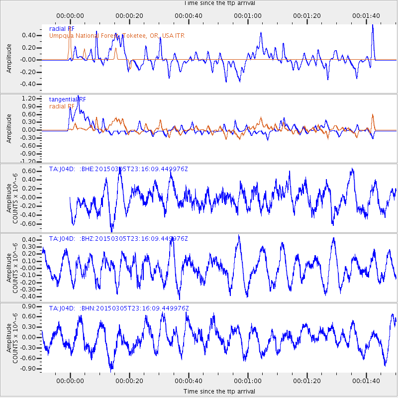
J04D Umpqua National Forest, Toketee, OR, USA - Earthquake Result Viewer
*The percent match for this event was below the threshold and hence no stack was calculated.
| Earthquake location: |
Hokkaido, Japan Region |
| Earthquake latitude/longitude: |
42.3/142.6 |
| Earthquake time(UTC): |
2015/03/05 (064) 23:06:00 GMT |
| Earthquake Depth: |
61 km |
| Earthquake Magnitude: |
4.8 MW |
| Earthquake Catalog/Contributor: |
ISC/ISC |
|
| Network: |
TA USArray Transportable Network (new EarthScope stations) |
| Station: |
J04D Umpqua National Forest, Toketee, OR, USA |
| Lat/Lon: |
43.24 N/122.11 W |
| Elevation: |
1948 m |
|
| Distance: |
65.9 deg |
| Az: |
52.84 deg |
| Baz: |
306.038 deg |
| Ray Param: |
$rayparam |
*The percent match for this event was below the threshold and hence was not used in the summary stack. |
|
| Radial Match: |
47.673622 % |
| Radial Bump: |
400 |
| Transverse Match: |
39.44202 % |
| Transverse Bump: |
400 |
| SOD ConfigId: |
7019011 |
| Insert Time: |
2019-04-17 05:20:42.795 +0000 |
| GWidth: |
2.5 |
| Max Bumps: |
400 |
| Tol: |
0.001 |
|
Signal To Noise
| Channel | StoN | STA | LTA |
| TA:J04D: :BHZ:20150305T23:16:09.449976Z | 1.0722655 | 1.3710198E-7 | 1.2786197E-7 |
| TA:J04D: :BHN:20150305T23:16:09.449976Z | 1.6343373 | 3.6532887E-7 | 2.2353335E-7 |
| TA:J04D: :BHE:20150305T23:16:09.449976Z | 1.1558329 | 3.3665455E-7 | 2.9126576E-7 |
| Arrivals |
| Ps | |
| PpPs | |
| PsPs/PpSs | |


