You are here: Home > Network List > TA - USArray Transportable Network (new EarthScope stations) Stations List
> Station N56A West Decatur, PA, USA > Earthquake Result Viewer
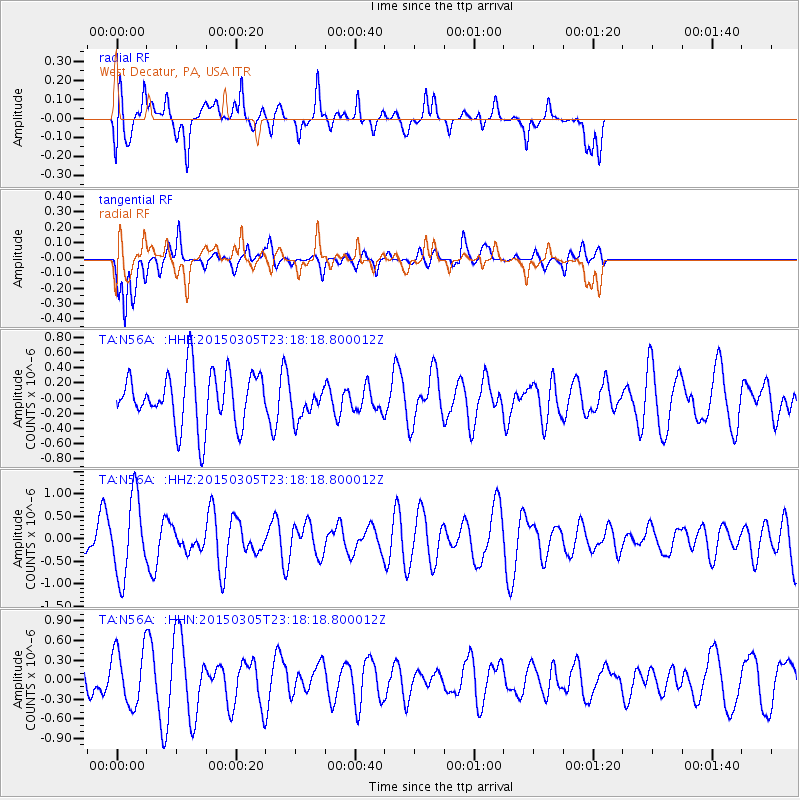
N56A West Decatur, PA, USA - Earthquake Result Viewer
*The percent match for this event was below the threshold and hence no stack was calculated.
| Earthquake location: |
Hokkaido, Japan Region |
| Earthquake latitude/longitude: |
42.3/142.6 |
| Earthquake time(UTC): |
2015/03/05 (064) 23:06:00 GMT |
| Earthquake Depth: |
61 km |
| Earthquake Magnitude: |
4.8 MW |
| Earthquake Catalog/Contributor: |
ISC/ISC |
|
| Network: |
TA USArray Transportable Network (new EarthScope stations) |
| Station: |
N56A West Decatur, PA, USA |
| Lat/Lon: |
40.92 N/78.30 W |
| Elevation: |
561 m |
|
| Distance: |
89.3 deg |
| Az: |
29.736 deg |
| Baz: |
330.968 deg |
| Ray Param: |
$rayparam |
*The percent match for this event was below the threshold and hence was not used in the summary stack. |
|
| Radial Match: |
52.46097 % |
| Radial Bump: |
400 |
| Transverse Match: |
72.707344 % |
| Transverse Bump: |
372 |
| SOD ConfigId: |
7019011 |
| Insert Time: |
2019-04-17 05:20:56.942 +0000 |
| GWidth: |
2.5 |
| Max Bumps: |
400 |
| Tol: |
0.001 |
|
Signal To Noise
| Channel | StoN | STA | LTA |
| TA:N56A: :HHZ:20150305T23:18:18.800012Z | 1.8226393 | 8.667187E-7 | 4.7552948E-7 |
| TA:N56A: :HHN:20150305T23:18:18.800012Z | 1.9585218 | 4.323358E-7 | 2.2074597E-7 |
| TA:N56A: :HHE:20150305T23:18:18.800012Z | 0.5900569 | 2.0871653E-7 | 3.5372273E-7 |
| Arrivals |
| Ps | |
| PpPs | |
| PsPs/PpSs | |


