You are here: Home > Network List > TA - USArray Transportable Network (new EarthScope stations) Stations List
> Station R11A Troy Canyon, Currant, NV, USA > Earthquake Result Viewer
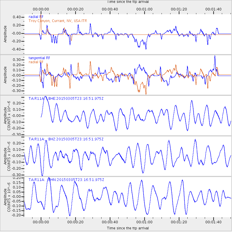
R11A Troy Canyon, Currant, NV, USA - Earthquake Result Viewer
*The percent match for this event was below the threshold and hence no stack was calculated.
| Earthquake location: |
Hokkaido, Japan Region |
| Earthquake latitude/longitude: |
42.3/142.6 |
| Earthquake time(UTC): |
2015/03/05 (064) 23:06:00 GMT |
| Earthquake Depth: |
61 km |
| Earthquake Magnitude: |
4.8 MW |
| Earthquake Catalog/Contributor: |
ISC/ISC |
|
| Network: |
TA USArray Transportable Network (new EarthScope stations) |
| Station: |
R11A Troy Canyon, Currant, NV, USA |
| Lat/Lon: |
38.35 N/115.59 W |
| Elevation: |
1756 m |
|
| Distance: |
72.8 deg |
| Az: |
53.651 deg |
| Baz: |
310.577 deg |
| Ray Param: |
$rayparam |
*The percent match for this event was below the threshold and hence was not used in the summary stack. |
|
| Radial Match: |
47.308502 % |
| Radial Bump: |
400 |
| Transverse Match: |
50.485943 % |
| Transverse Bump: |
400 |
| SOD ConfigId: |
7019011 |
| Insert Time: |
2019-04-17 05:21:03.594 +0000 |
| GWidth: |
2.5 |
| Max Bumps: |
400 |
| Tol: |
0.001 |
|
Signal To Noise
| Channel | StoN | STA | LTA |
| TA:R11A: :BHZ:20150305T23:16:51.975Z | 2.2621012 | 1.8524268E-7 | 8.188965E-8 |
| TA:R11A: :BHN:20150305T23:16:51.975Z | 1.0701939 | 1.2006393E-7 | 1.1218895E-7 |
| TA:R11A: :BHE:20150305T23:16:51.975Z | 0.7005305 | 8.274274E-8 | 1.18114386E-7 |
| Arrivals |
| Ps | |
| PpPs | |
| PsPs/PpSs | |


