ABKT Alibek, Turkmenistan - Earthquake Result Viewer
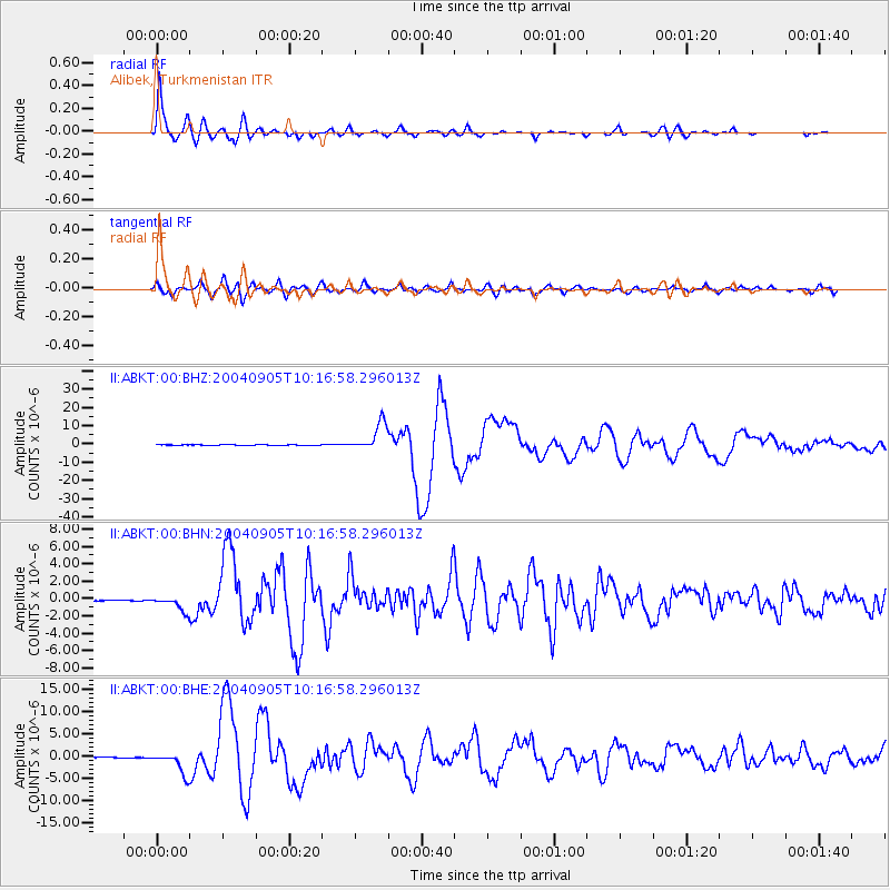
Earthquake location: Near S. Coast Of Western Honshu
Earthquake latitude/longitude: 33.1/136.6
Earthquake time(UTC): 2004/09/05 (249) 10:07:07 GMT
Earthquake Depth: 14 km
Earthquake Magnitude: 6.7 MB, 7.0 MS, 7.2 MW, 7.0 MW
Earthquake Catalog/Contributor: WHDF/NEIC
Network: II Global Seismograph Network (GSN - IRIS/IDA)
Station: ABKT Alibek, Turkmenistan
Lat/Lon: 37.93 N/58.12 E
Elevation: 678 m
Distance: 62.3 deg
Az: 298.935 deg
Baz: 68.328 deg
Ray Param: 0.06030813
Estimated Moho Depth: 12.75 km
Estimated Crust Vp/Vs: 1.60
Assumed Crust Vp: 6.53 km/s
Estimated Crust Vs: 4.082 km/s
Estimated Crust Poisson's Ratio: 0.18
Radial Match: 95.78631 %
Radial Bump: 400
Transverse Match: 85.66131 %
Transverse Bump: 400
SOD ConfigId: 2459
Insert Time: 2010-03-01 22:41:35.667 +0000
GWidth: 2.5
Max Bumps: 400
Tol: 0.001

Signal To Noise

ChannelStoNSTALTA
II:ABKT:00:BHN:20040905T10:16:58.296013Z24.5288168.1638603E-73.328273E-8
II:ABKT:00:BHE:20040905T10:16:58.296013Z75.789872.4519995E-63.23526E-8
II:ABKT:00:BHZ:20040905T10:16:58.296013Z101.865727.570471E-67.4318145E-8
Arrivals
Ps1.2 SECOND
PpPs4.8 SECOND
PsPs/PpSs6.1 SECOND