You are here: Home > Network List > IU - Global Seismograph Network (GSN - IRIS/USGS) Stations List
> Station MAJO Matsushiro, Japan > Earthquake Result Viewer
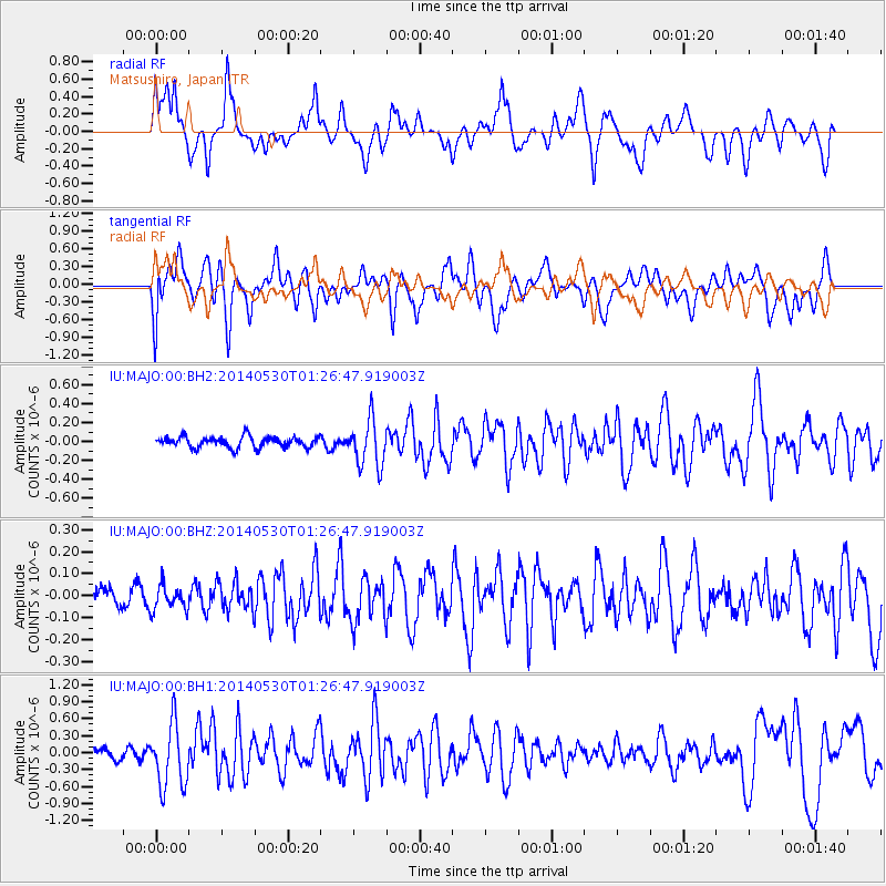
MAJO Matsushiro, Japan - Earthquake Result Viewer
*The percent match for this event was below the threshold and hence no stack was calculated.
| Earthquake location: |
Myanmar-China Border Region |
| Earthquake latitude/longitude: |
25.0/97.9 |
| Earthquake time(UTC): |
2014/05/30 (150) 01:20:15 GMT |
| Earthquake Depth: |
10 km |
| Earthquake Magnitude: |
5.9 MB |
| Earthquake Catalog/Contributor: |
NEIC PDE/NEIC COMCAT |
|
| Network: |
IU Global Seismograph Network (GSN - IRIS/USGS) |
| Station: |
MAJO Matsushiro, Japan |
| Lat/Lon: |
36.55 N/138.20 E |
| Elevation: |
405 m |
|
| Distance: |
36.3 deg |
| Az: |
61.73 deg |
| Baz: |
263.014 deg |
| Ray Param: |
$rayparam |
*The percent match for this event was below the threshold and hence was not used in the summary stack. |
|
| Radial Match: |
46.961143 % |
| Radial Bump: |
400 |
| Transverse Match: |
49.759502 % |
| Transverse Bump: |
400 |
| SOD ConfigId: |
626651 |
| Insert Time: |
2014-06-13 01:43:36.158 +0000 |
| GWidth: |
2.5 |
| Max Bumps: |
400 |
| Tol: |
0.001 |
|
Signal To Noise
| Channel | StoN | STA | LTA |
| IU:MAJO:00:BHZ:20140530T01:26:47.919003Z | 1.6019723 | 5.5415214E-8 | 3.4591867E-8 |
| IU:MAJO:00:BH1:20140530T01:26:47.919003Z | 7.271609 | 5.583714E-7 | 7.678788E-8 |
| IU:MAJO:00:BH2:20140530T01:26:47.919003Z | 4.2627153 | 2.4600135E-7 | 5.7710015E-8 |
| Arrivals |
| Ps | |
| PpPs | |
| PsPs/PpSs | |


