ABKT Alibek, Turkmenistan - Earthquake Result Viewer
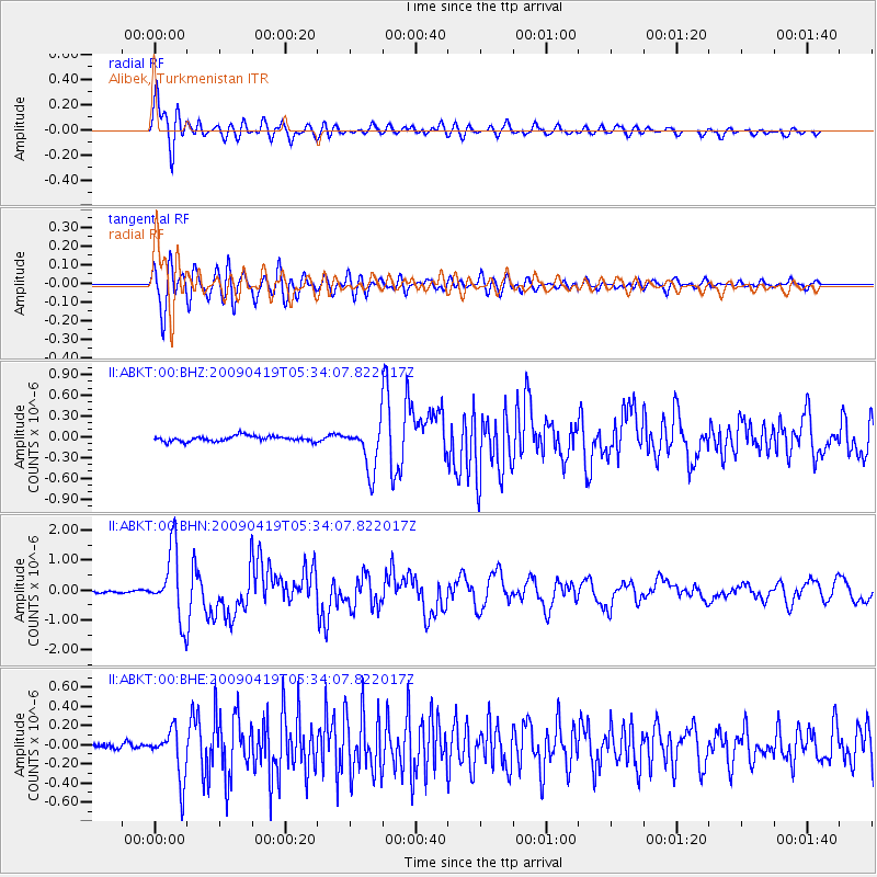
Earthquake location: Talaud Islands, Indonesia
Earthquake latitude/longitude: 4.1/126.7
Earthquake time(UTC): 2009/04/19 (109) 05:23:25 GMT
Earthquake Depth: 25 km
Earthquake Magnitude: 5.9 MB, 5.9 MS, 6.1 MW, 6.1 MW
Earthquake Catalog/Contributor: WHDF/NEIC
Network: II Global Seismograph Network (GSN - IRIS/IDA)
Station: ABKT Alibek, Turkmenistan
Lat/Lon: 37.93 N/58.12 E
Elevation: 678 m
Distance: 70.6 deg
Az: 308.709 deg
Baz: 100.169 deg
Ray Param: 0.054844204
Estimated Moho Depth: 20.25 km
Estimated Crust Vp/Vs: 2.10
Assumed Crust Vp: 6.53 km/s
Estimated Crust Vs: 3.113 km/s
Estimated Crust Poisson's Ratio: 0.35
Radial Match: 94.30564 %
Radial Bump: 400
Transverse Match: 88.428795 %
Transverse Bump: 400
SOD ConfigId: 2760
Insert Time: 2010-03-01 22:42:35.282 +0000
GWidth: 2.5
Max Bumps: 400
Tol: 0.001

Signal To Noise

ChannelStoNSTALTA
II:ABKT:00:BHN:20090419T05:34:07.822017Z27.0700111.1430732E-64.222655E-8
II:ABKT:00:BHE:20090419T05:34:07.822017Z8.2104542.574687E-73.1358645E-8
II:ABKT:00:BHZ:20090419T05:34:07.822017Z8.6911533.328353E-73.8295873E-8
Arrivals
Ps3.5 SECOND
PpPs9.3 SECOND
PsPs/PpSs13 SECOND