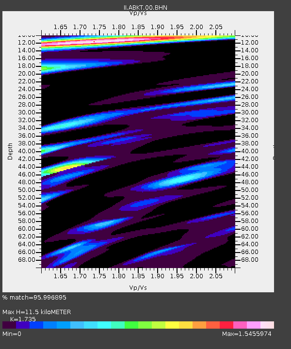
ABKT Alibek, Turkmenistan - Earthquake Result Viewer
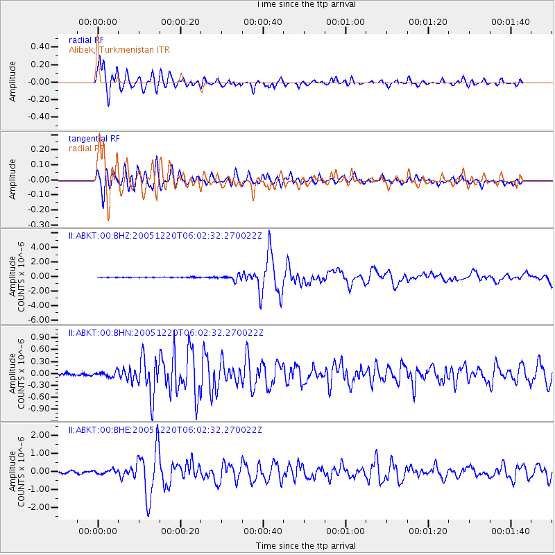
Earthquake location: W. Caroline Islands, Micronesia
Earthquake latitude/longitude: 12.2/141.0
Earthquake time(UTC): 2005/12/20 (354) 05:51:12 GMT
Earthquake Depth: 23 km
Earthquake Magnitude: 5.8 MB, 5.7 MS, 6.1 MW, 6.1 MW
Earthquake Catalog/Contributor: WHDF/NEIC
Network: II Global Seismograph Network (GSN - IRIS/IDA)
Station: ABKT Alibek, Turkmenistan
Lat/Lon: 37.93 N/58.12 E
Elevation: 678 m
Distance: 77.0 deg
Az: 306.366 deg
Baz: 84.567 deg
Ray Param: 0.050584003
Estimated Moho Depth: 11.5 km
Estimated Crust Vp/Vs: 1.74
Assumed Crust Vp: 6.53 km/s
Estimated Crust Vs: 3.764 km/s
Estimated Crust Poisson's Ratio: 0.25
Radial Match: 95.996895 %
Radial Bump: 400
Transverse Match: 92.24707 %
Transverse Bump: 400
SOD ConfigId: 2564
Insert Time: 2010-03-01 22:42:43.353 +0000
GWidth: 2.5
Max Bumps: 400
Tol: 0.001

Signal To Noise

ChannelStoNSTALTA
II:ABKT:00:BHN:20051220T06:02:32.270022Z2.07007676.7127374E-83.242748E-8
II:ABKT:00:BHE:20051220T06:02:32.270022Z2.22681141.0800147E-74.8500503E-8
II:ABKT:00:BHZ:20051220T06:02:32.270022Z7.67965653.3865868E-74.4098154E-8
Arrivals
Ps1.3 SECOND
PpPs4.7 SECOND
PsPs/PpSs6.0 SECOND