You are here: Home > Network List > GS - US Geological Survey Networks Stations List
> Station KAN13 Rinehart Farm > Earthquake Result Viewer
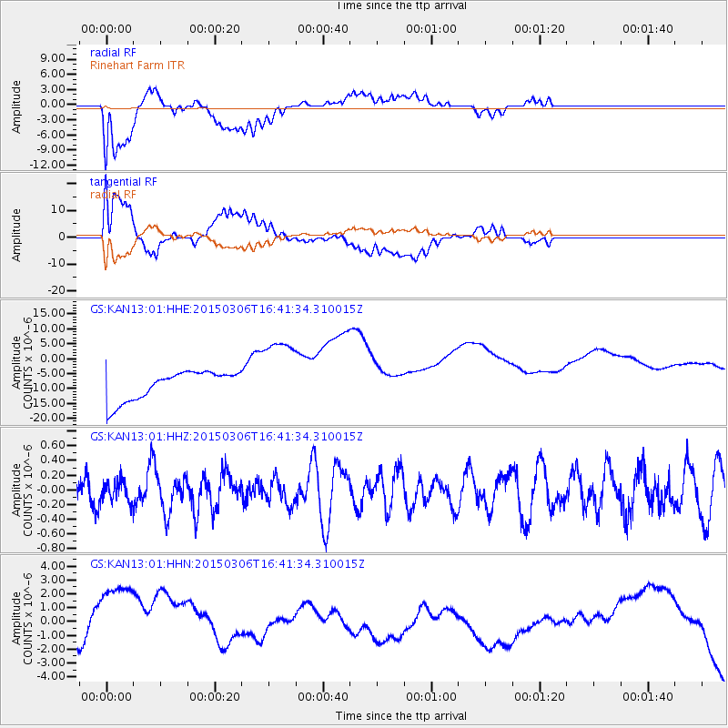
KAN13 Rinehart Farm - Earthquake Result Viewer
*The percent match for this event was below the threshold and hence no stack was calculated.
| Earthquake location: |
Kuril Islands |
| Earthquake latitude/longitude: |
43.8/146.1 |
| Earthquake time(UTC): |
2015/03/06 (065) 16:30:00 GMT |
| Earthquake Depth: |
87 km |
| Earthquake Magnitude: |
4.2 mb |
| Earthquake Catalog/Contributor: |
ISC/ISC |
|
| Network: |
GS US Geological Survey Networks |
| Station: |
KAN13 Rinehart Farm |
| Lat/Lon: |
37.01 N/97.48 W |
| Elevation: |
340 m |
|
| Distance: |
81.0 deg |
| Az: |
46.544 deg |
| Baz: |
318.99 deg |
| Ray Param: |
$rayparam |
*The percent match for this event was below the threshold and hence was not used in the summary stack. |
|
| Radial Match: |
43.980083 % |
| Radial Bump: |
400 |
| Transverse Match: |
43.805145 % |
| Transverse Bump: |
400 |
| SOD ConfigId: |
7019011 |
| Insert Time: |
2019-04-17 05:36:47.802 +0000 |
| GWidth: |
2.5 |
| Max Bumps: |
400 |
| Tol: |
0.001 |
|
Signal To Noise
| Channel | StoN | STA | LTA |
| GS:KAN13:01:HHZ:20150306T16:41:34.310015Z | 0.63934577 | 1.4265176E-7 | 2.2312145E-7 |
| GS:KAN13:01:HHN:20150306T16:41:34.310015Z | 2.4555142 | 4.40737E-6 | 1.7948867E-6 |
| GS:KAN13:01:HHE:20150306T16:41:34.310015Z | 2.6308362 | 1.2883371E-5 | 4.897063E-6 |
| Arrivals |
| Ps | |
| PpPs | |
| PsPs/PpSs | |


