You are here: Home > Network List > TA - USArray Transportable Network (new EarthScope stations) Stations List
> Station K61A Williamstown, MA, USA > Earthquake Result Viewer
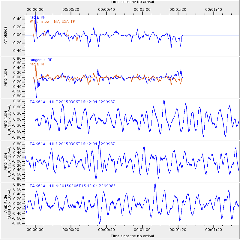
K61A Williamstown, MA, USA - Earthquake Result Viewer
*The percent match for this event was below the threshold and hence no stack was calculated.
| Earthquake location: |
Kuril Islands |
| Earthquake latitude/longitude: |
43.8/146.1 |
| Earthquake time(UTC): |
2015/03/06 (065) 16:30:00 GMT |
| Earthquake Depth: |
87 km |
| Earthquake Magnitude: |
4.2 mb |
| Earthquake Catalog/Contributor: |
ISC/ISC |
|
| Network: |
TA USArray Transportable Network (new EarthScope stations) |
| Station: |
K61A Williamstown, MA, USA |
| Lat/Lon: |
42.67 N/73.27 W |
| Elevation: |
391 m |
|
| Distance: |
86.9 deg |
| Az: |
27.953 deg |
| Baz: |
332.621 deg |
| Ray Param: |
$rayparam |
*The percent match for this event was below the threshold and hence was not used in the summary stack. |
|
| Radial Match: |
62.443993 % |
| Radial Bump: |
400 |
| Transverse Match: |
69.32575 % |
| Transverse Bump: |
400 |
| SOD ConfigId: |
7019011 |
| Insert Time: |
2019-04-17 05:40:14.596 +0000 |
| GWidth: |
2.5 |
| Max Bumps: |
400 |
| Tol: |
0.001 |
|
Signal To Noise
| Channel | StoN | STA | LTA |
| TA:K61A: :HHZ:20150306T16:42:04.229998Z | 0.47149166 | 1.5399769E-7 | 3.2661805E-7 |
| TA:K61A: :HHN:20150306T16:42:04.229998Z | 1.4466428 | 3.170191E-7 | 2.1914126E-7 |
| TA:K61A: :HHE:20150306T16:42:04.229998Z | 0.93236446 | 2.8678087E-7 | 3.0758451E-7 |
| Arrivals |
| Ps | |
| PpPs | |
| PsPs/PpSs | |


