ABKT Alibek, Turkmenistan - Earthquake Result Viewer
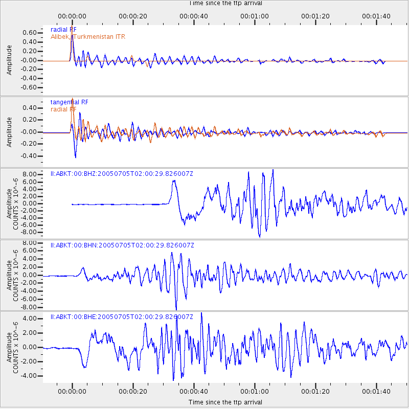
Earthquake location: Northern Sumatra, Indonesia
Earthquake latitude/longitude: 1.8/97.1
Earthquake time(UTC): 2005/07/05 (186) 01:52:02 GMT
Earthquake Depth: 21 km
Earthquake Magnitude: 6.2 MB, 6.8 MS, 6.7 MW, 6.6 MW
Earthquake Catalog/Contributor: WHDF/NEIC
Network: II Global Seismograph Network (GSN - IRIS/IDA)
Station: ABKT Alibek, Turkmenistan
Lat/Lon: 37.93 N/58.12 E
Elevation: 678 m
Distance: 50.7 deg
Az: 319.993 deg
Baz: 125.65 deg
Ray Param: 0.067874275
Estimated Moho Depth: 36.25 km
Estimated Crust Vp/Vs: 1.88
Assumed Crust Vp: 6.53 km/s
Estimated Crust Vs: 3.464 km/s
Estimated Crust Poisson's Ratio: 0.30
Radial Match: 96.835594 %
Radial Bump: 400
Transverse Match: 95.61621 %
Transverse Bump: 400
SOD ConfigId: 2475
Insert Time: 2010-03-01 22:43:24.006 +0000
GWidth: 2.5
Max Bumps: 400
Tol: 0.001

Signal To Noise

ChannelStoNSTALTA
II:ABKT:00:BHN:20050705T02:00:29.826007Z21.703578.395085E-73.8680668E-8
II:ABKT:00:BHE:20050705T02:00:29.826007Z37.706641.3747548E-63.6459223E-8
II:ABKT:00:BHZ:20050705T02:00:29.826007Z67.8624953.2803473E-64.8338148E-8
Arrivals
Ps5.2 SECOND
PpPs15 SECOND
PsPs/PpSs20 SECOND