You are here: Home > Network List > CI - Caltech Regional Seismic Network Stations List
> Station MPM Manuel Prospect Mine, California, USA > Earthquake Result Viewer
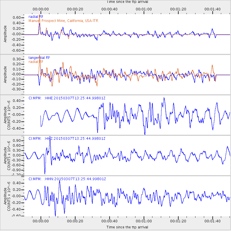
MPM Manuel Prospect Mine, California, USA - Earthquake Result Viewer
*The percent match for this event was below the threshold and hence no stack was calculated.
| Earthquake location: |
Andreanof Islands, Aleutian Is. |
| Earthquake latitude/longitude: |
50.5/-173.3 |
| Earthquake time(UTC): |
2015/03/07 (066) 13:18:24 GMT |
| Earthquake Depth: |
10 km |
| Earthquake Magnitude: |
5.7 MO |
| Earthquake Catalog/Contributor: |
NEIC PDE/NEIC ALERT |
|
| Network: |
CI Caltech Regional Seismic Network |
| Station: |
MPM Manuel Prospect Mine, California, USA |
| Lat/Lon: |
36.06 N/117.49 W |
| Elevation: |
185 m |
|
| Distance: |
42.1 deg |
| Az: |
87.984 deg |
| Baz: |
308.092 deg |
| Ray Param: |
$rayparam |
*The percent match for this event was below the threshold and hence was not used in the summary stack. |
|
| Radial Match: |
61.865517 % |
| Radial Bump: |
400 |
| Transverse Match: |
39.46276 % |
| Transverse Bump: |
400 |
| SOD ConfigId: |
7019011 |
| Insert Time: |
2019-04-17 05:46:42.000 +0000 |
| GWidth: |
2.5 |
| Max Bumps: |
400 |
| Tol: |
0.001 |
|
Signal To Noise
| Channel | StoN | STA | LTA |
| CI:MPM: :HHZ:20150307T13:25:44.99801Z | 3.0724375 | 3.666266E-7 | 1.1932761E-7 |
| CI:MPM: :HHN:20150307T13:25:44.99801Z | 1.1616187 | 1.8815702E-7 | 1.6197829E-7 |
| CI:MPM: :HHE:20150307T13:25:44.99801Z | 1.668122 | 1.8730267E-7 | 1.1228355E-7 |
| Arrivals |
| Ps | |
| PpPs | |
| PsPs/PpSs | |


