
ABKT Alibek, Turkmenistan - Earthquake Result Viewer
| ||||||||||||||||||
| ||||||||||||||||||
| ||||||||||||||||||
|
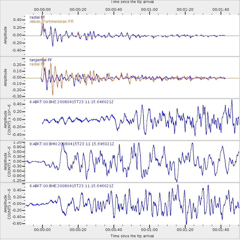
Signal To Noise
| Channel | StoN | STA | LTA |
| II:ABKT:00:BHN:20080415T23:11:15.646021Z | 3.9101894 | 1.7790956E-7 | 4.549896E-8 |
| II:ABKT:00:BHE:20080415T23:11:15.646021Z | 1.2419857 | 3.9267785E-8 | 3.161694E-8 |
| II:ABKT:00:BHZ:20080415T23:11:15.646021Z | 1.0851156 | 4.40821E-8 | 4.062434E-8 |
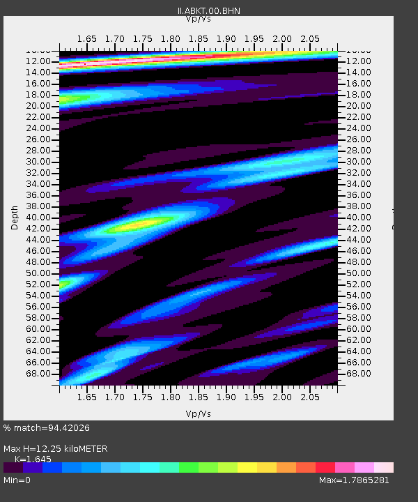
| Arrivals | |
| Ps | 1.3 SECOND |
| PpPs | 4.8 SECOND |
| PsPs/PpSs | 6.0 SECOND |

