You are here: Home > Network List > TA - USArray Transportable Network (new EarthScope stations) Stations List
> Station E51A G1948 Merrick Township, ON, CAN > Earthquake Result Viewer
E51A G1948 Merrick Township, ON, CAN - Earthquake Result Viewer

| Earthquake location: |
Off Coast Of Jalisco, Mexico |
| Earthquake latitude/longitude: |
18.9/-107.4 |
| Earthquake time(UTC): |
2014/05/31 (151) 11:53:48 GMT |
| Earthquake Depth: |
10 km |
| Earthquake Magnitude: |
6.2 MWP, 6.6 MI |
| Earthquake Catalog/Contributor: |
NEIC PDE/NEIC COMCAT |
|
| Network: |
TA USArray Transportable Network (new EarthScope stations) |
| Station: |
E51A G1948 Merrick Township, ON, CAN |
| Lat/Lon: |
46.53 N/79.49 W |
| Elevation: |
369 m |
|
| Distance: |
35.9 deg |
| Az: |
33.48 deg |
| Baz: |
229.177 deg |
| Ray Param: |
0.07696493 |
| Estimated Moho Depth: |
40.5 km |
| Estimated Crust Vp/Vs: |
1.65 |
| Assumed Crust Vp: |
6.622 km/s |
| Estimated Crust Vs: |
4.007 km/s |
| Estimated Crust Poisson's Ratio: |
0.21 |
|
| Radial Match: |
91.50364 % |
| Radial Bump: |
178 |
| Transverse Match: |
78.75943 % |
| Transverse Bump: |
400 |
| SOD ConfigId: |
626651 |
| Insert Time: |
2014-06-14 12:29:56.789 +0000 |
| GWidth: |
2.5 |
| Max Bumps: |
400 |
| Tol: |
0.001 |
|
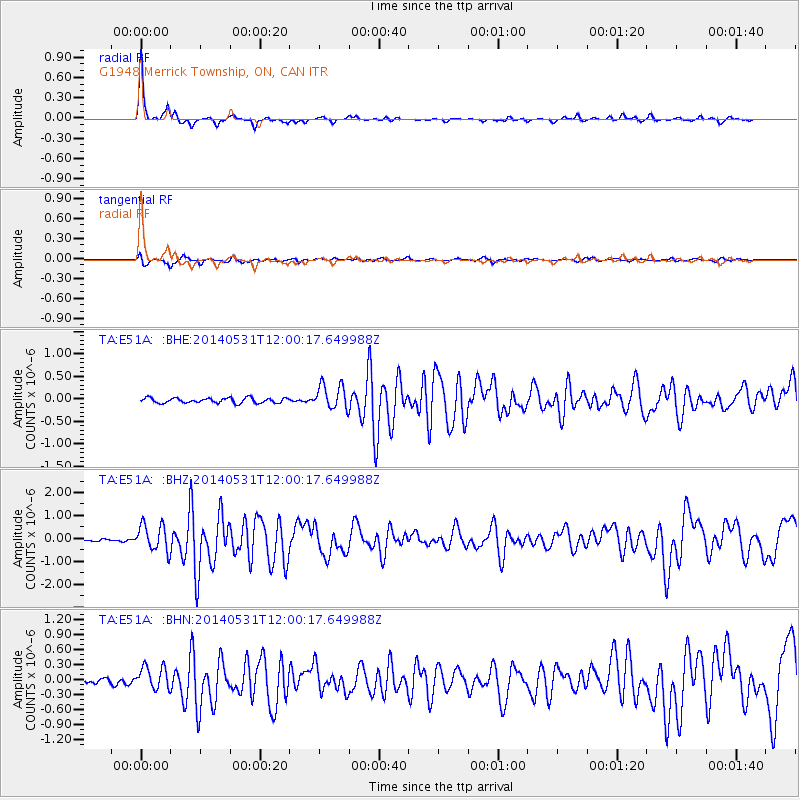
Signal To Noise
| Channel | StoN | STA | LTA |
| TA:E51A: :BHZ:20140531T12:00:17.649988Z | 9.088701 | 5.9487746E-7 | 6.545242E-8 |
| TA:E51A: :BHN:20140531T12:00:17.649988Z | 3.36679 | 2.3055644E-7 | 6.84796E-8 |
| TA:E51A: :BHE:20140531T12:00:17.649988Z | 5.026872 | 2.7673096E-7 | 5.505033E-8 |
| Arrivals |
| Ps | 4.4 SECOND |
| PpPs | 15 SECOND |
| PsPs/PpSs | 19 SECOND |


