ABKT Alibek, Turkmenistan - Earthquake Result Viewer
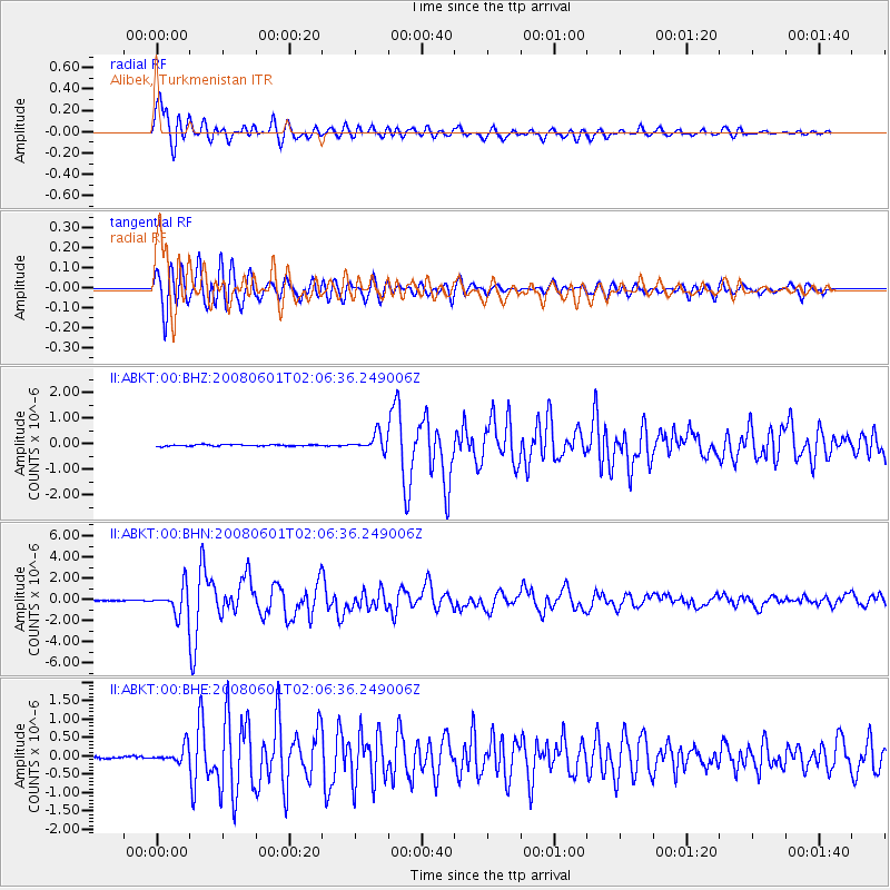
Earthquake location: Philippine Islands Region
Earthquake latitude/longitude: 20.1/121.4
Earthquake time(UTC): 2008/06/01 (153) 01:57:24 GMT
Earthquake Depth: 35 km
Earthquake Magnitude: 6.0 MB, 6.2 MS, 6.3 MW, 6.2 MW
Earthquake Catalog/Contributor: WHDF/NEIC
Network: II Global Seismograph Network (GSN - IRIS/IDA)
Station: ABKT Alibek, Turkmenistan
Lat/Lon: 37.93 N/58.12 E
Elevation: 678 m
Distance: 57.1 deg
Az: 302.708 deg
Baz: 89.208 deg
Ray Param: 0.06367257
Estimated Moho Depth: 12.75 km
Estimated Crust Vp/Vs: 1.71
Assumed Crust Vp: 6.53 km/s
Estimated Crust Vs: 3.83 km/s
Estimated Crust Poisson's Ratio: 0.24
Radial Match: 95.74344 %
Radial Bump: 400
Transverse Match: 94.48299 %
Transverse Bump: 400
SOD ConfigId: 2504
Insert Time: 2010-03-01 22:44:49.902 +0000
GWidth: 2.5
Max Bumps: 400
Tol: 0.001

Signal To Noise

ChannelStoNSTALTA
II:ABKT:00:BHN:20080601T02:06:36.249006Z30.779881.3108636E-64.2588326E-8
II:ABKT:00:BHE:20080601T02:06:36.249006Z8.39174652.2050337E-72.627622E-8
II:ABKT:00:BHZ:20080601T02:06:36.249006Z10.9458713.2255033E-72.9467763E-8
Arrivals
Ps1.5 SECOND
PpPs5.0 SECOND
PsPs/PpSs6.5 SECOND