ABKT Alibek, Turkmenistan - Earthquake Result Viewer
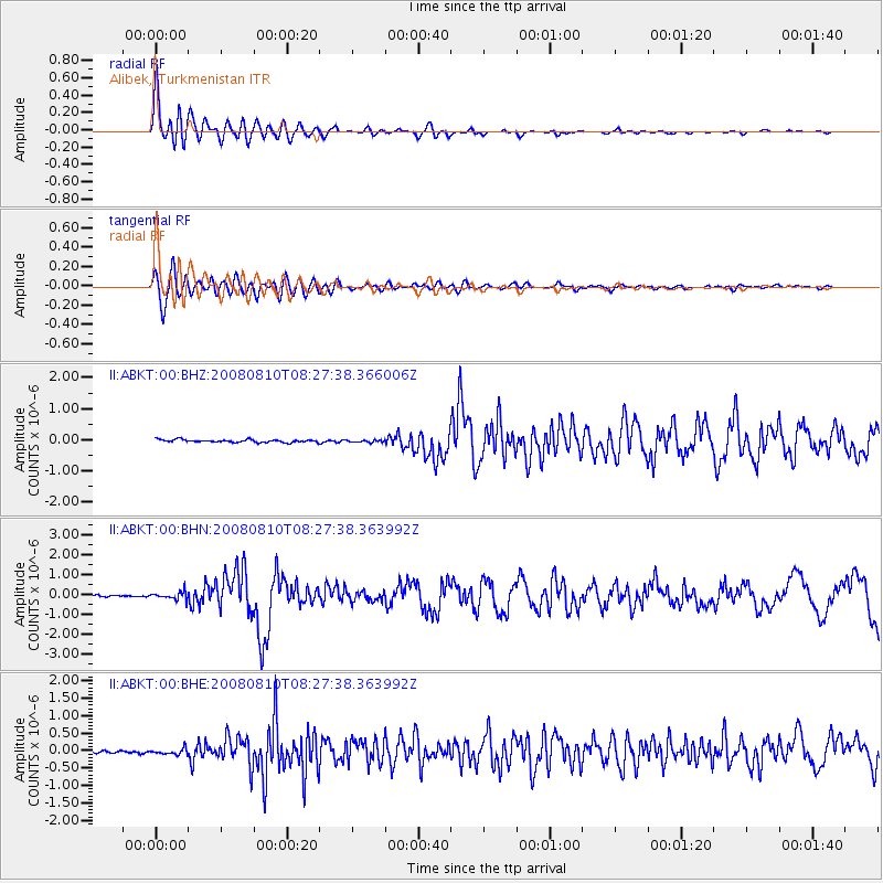
Earthquake location: Andaman Islands, India Region
Earthquake latitude/longitude: 11.0/91.8
Earthquake time(UTC): 2008/08/10 (223) 08:20:31 GMT
Earthquake Depth: 10 km
Earthquake Magnitude: 5.7 MB, 6.1 MS, 6.2 MW, 6.2 MW
Earthquake Catalog/Contributor: WHDF/NEIC
Network: II Global Seismograph Network (GSN - IRIS/IDA)
Station: ABKT Alibek, Turkmenistan
Lat/Lon: 37.93 N/58.12 E
Elevation: 678 m
Distance: 40.3 deg
Az: 317.322 deg
Baz: 122.691 deg
Ray Param: 0.07446296
Estimated Moho Depth: 37.75 km
Estimated Crust Vp/Vs: 1.85
Assumed Crust Vp: 6.53 km/s
Estimated Crust Vs: 3.535 km/s
Estimated Crust Poisson's Ratio: 0.29
Radial Match: 95.463554 %
Radial Bump: 400
Transverse Match: 82.73446 %
Transverse Bump: 400
SOD ConfigId: 2504
Insert Time: 2010-03-01 22:45:31.167 +0000
GWidth: 2.5
Max Bumps: 400
Tol: 0.001

Signal To Noise

ChannelStoNSTALTA
II:ABKT:00:BHN:20080810T08:27:38.363992Z3.30364921.9882368E-76.0183055E-8
II:ABKT:00:BHE:20080810T08:27:38.363992Z1.97042358.5274685E-84.327734E-8
II:ABKT:00:BHZ:20080810T08:27:38.366006Z0.84785853.7149793E-84.3816033E-8
Arrivals
Ps5.3 SECOND
PpPs15 SECOND
PsPs/PpSs21 SECOND