You are here: Home > Network List > LD - Lamont-Doherty Cooperative Seismographic Network Stations List
> Station MVL Millersville University, PA > Earthquake Result Viewer
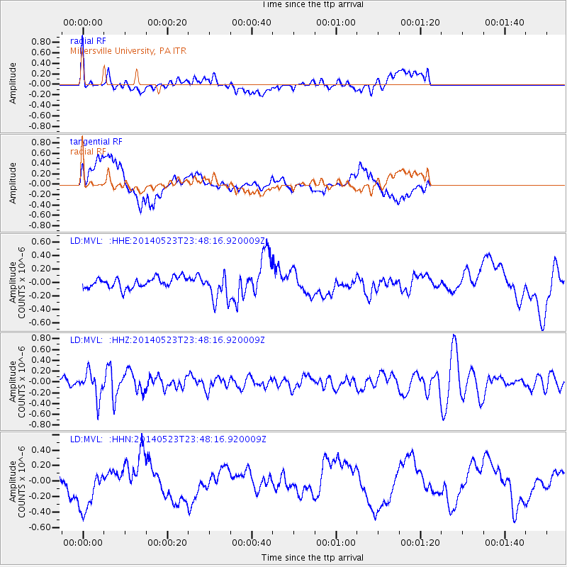
MVL Millersville University, PA - Earthquake Result Viewer
*The percent match for this event was below the threshold and hence no stack was calculated.
| Earthquake location: |
Northern Mid-Atlantic Ridge |
| Earthquake latitude/longitude: |
45.0/-27.8 |
| Earthquake time(UTC): |
2014/05/23 (143) 23:41:49 GMT |
| Earthquake Depth: |
10 km |
| Earthquake Magnitude: |
5.5 MWC, 5.5 MWC |
| Earthquake Catalog/Contributor: |
NEIC PDE/NEIC COMCAT |
|
| Network: |
LD Lamont-Doherty Cooperative Seismographic Network |
| Station: |
MVL Millersville University, PA |
| Lat/Lon: |
40.00 N/76.35 W |
| Elevation: |
91 m |
|
| Distance: |
35.7 deg |
| Az: |
279.381 deg |
| Baz: |
65.589 deg |
| Ray Param: |
$rayparam |
*The percent match for this event was below the threshold and hence was not used in the summary stack. |
|
| Radial Match: |
45.021965 % |
| Radial Bump: |
400 |
| Transverse Match: |
69.8529 % |
| Transverse Bump: |
400 |
| SOD ConfigId: |
626651 |
| Insert Time: |
2014-06-15 05:22:01.435 +0000 |
| GWidth: |
2.5 |
| Max Bumps: |
400 |
| Tol: |
0.001 |
|
Signal To Noise
| Channel | StoN | STA | LTA |
| LD:MVL: :HHZ:20140523T23:48:16.920009Z | 3.605617 | 2.4811212E-7 | 6.881267E-8 |
| LD:MVL: :HHN:20140523T23:48:16.920009Z | 2.0379245 | 3.0796852E-7 | 1.511187E-7 |
| LD:MVL: :HHE:20140523T23:48:16.920009Z | 2.7026274 | 2.095556E-7 | 7.753773E-8 |
| Arrivals |
| Ps | |
| PpPs | |
| PsPs/PpSs | |


