You are here: Home > Network List > UW - Pacific Northwest Regional Seismic Network Stations List
> Station MRBL Marblemount, WA, USA > Earthquake Result Viewer
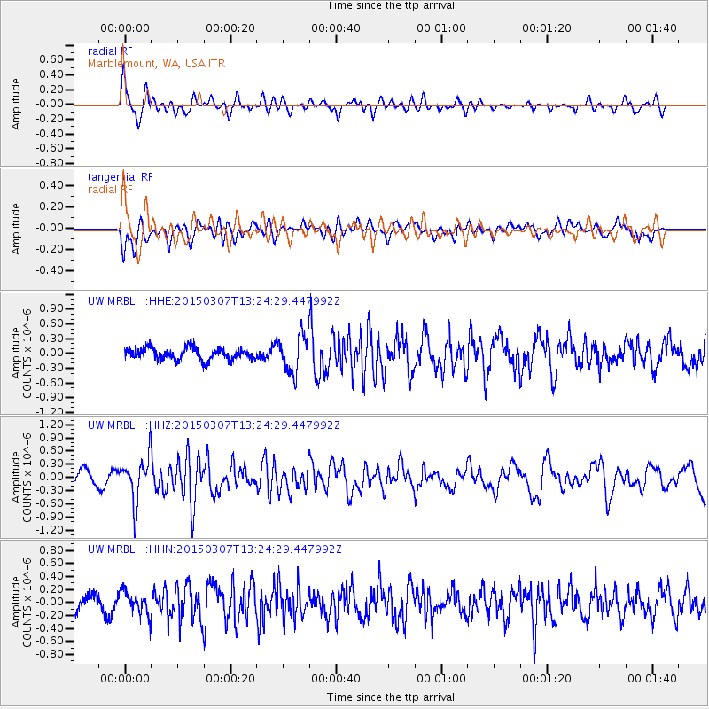
MRBL Marblemount, WA, USA - Earthquake Result Viewer
*The percent match for this event was below the threshold and hence no stack was calculated.
| Earthquake location: |
Andreanof Islands, Aleutian Is. |
| Earthquake latitude/longitude: |
50.5/-173.3 |
| Earthquake time(UTC): |
2015/03/07 (066) 13:18:24 GMT |
| Earthquake Depth: |
10 km |
| Earthquake Magnitude: |
5.7 MO |
| Earthquake Catalog/Contributor: |
NEIC PDE/NEIC ALERT |
|
| Network: |
UW Pacific Northwest Regional Seismic Network |
| Station: |
MRBL Marblemount, WA, USA |
| Lat/Lon: |
48.52 N/121.48 W |
| Elevation: |
75 m |
|
| Distance: |
33.1 deg |
| Az: |
72.947 deg |
| Baz: |
293.428 deg |
| Ray Param: |
$rayparam |
*The percent match for this event was below the threshold and hence was not used in the summary stack. |
|
| Radial Match: |
61.72511 % |
| Radial Bump: |
400 |
| Transverse Match: |
53.2411 % |
| Transverse Bump: |
400 |
| SOD ConfigId: |
7019011 |
| Insert Time: |
2019-04-17 05:56:47.199 +0000 |
| GWidth: |
2.5 |
| Max Bumps: |
400 |
| Tol: |
0.001 |
|
Signal To Noise
| Channel | StoN | STA | LTA |
| UW:MRBL: :HHZ:20150307T13:24:29.447992Z | 4.5104375 | 5.1325776E-7 | 1.1379334E-7 |
| UW:MRBL: :HHN:20150307T13:24:29.447992Z | 1.2281098 | 1.7833828E-7 | 1.4521363E-7 |
| UW:MRBL: :HHE:20150307T13:24:29.447992Z | 3.5451431 | 4.2557406E-7 | 1.2004426E-7 |
| Arrivals |
| Ps | |
| PpPs | |
| PsPs/PpSs | |


