ABKT Alibek, Turkmenistan - Earthquake Result Viewer
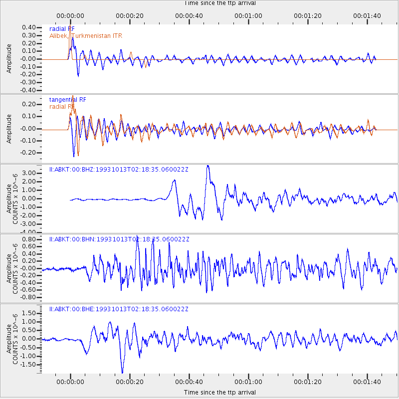
Earthquake location: Eastern New Guinea Reg., P.N.G.
Earthquake latitude/longitude: -5.9/146.0
Earthquake time(UTC): 1993/10/13 (286) 02:06:00 GMT
Earthquake Depth: 24 km
Earthquake Magnitude: 6.4 MB, 7.1 MS, 6.7 UNKNOWN, 7.1 ML
Earthquake Catalog/Contributor: WHDF/NEIC
Network: II Global Seismograph Network (GSN - IRIS/IDA)
Station: ABKT Alibek, Turkmenistan
Lat/Lon: 37.93 N/58.12 E
Elevation: 678 m
Distance: 92.0 deg
Az: 307.75 deg
Baz: 95.935 deg
Ray Param: 0.04152633
Estimated Moho Depth: 17.75 km
Estimated Crust Vp/Vs: 1.61
Assumed Crust Vp: 6.53 km/s
Estimated Crust Vs: 4.069 km/s
Estimated Crust Poisson's Ratio: 0.18
Radial Match: 94.47285 %
Radial Bump: 400
Transverse Match: 86.3809 %
Transverse Bump: 400
SOD ConfigId: 61242
Insert Time: 2010-03-01 22:47:11.223 +0000
GWidth: 2.5
Max Bumps: 400
Tol: 0.001

Signal To Noise

ChannelStoNSTALTA
II:ABKT:00:BHN:19931013T02:18:35.060022Z0.874161363.1829668E-83.6411663E-8
II:ABKT:00:BHE:19931013T02:18:35.060022Z4.61016271.8499479E-74.0127603E-8
II:ABKT:00:BHZ:19931013T02:18:35.060022Z14.8891868.052862E-75.408531E-8
Arrivals
Ps1.7 SECOND
PpPs6.9 SECOND
PsPs/PpSs8.6 SECOND