You are here: Home > Network List > TA - USArray Transportable Network (new EarthScope stations) Stations List
> Station P54A Burton, WV, USA > Earthquake Result Viewer
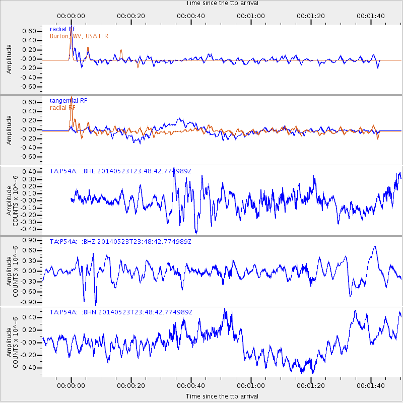
P54A Burton, WV, USA - Earthquake Result Viewer
*The percent match for this event was below the threshold and hence no stack was calculated.
| Earthquake location: |
Northern Mid-Atlantic Ridge |
| Earthquake latitude/longitude: |
45.0/-27.8 |
| Earthquake time(UTC): |
2014/05/23 (143) 23:41:49 GMT |
| Earthquake Depth: |
10 km |
| Earthquake Magnitude: |
5.5 MWC, 5.5 MWC |
| Earthquake Catalog/Contributor: |
NEIC PDE/NEIC COMCAT |
|
| Network: |
TA USArray Transportable Network (new EarthScope stations) |
| Station: |
P54A Burton, WV, USA |
| Lat/Lon: |
39.61 N/80.48 W |
| Elevation: |
473 m |
|
| Distance: |
38.7 deg |
| Az: |
281.027 deg |
| Baz: |
64.267 deg |
| Ray Param: |
$rayparam |
*The percent match for this event was below the threshold and hence was not used in the summary stack. |
|
| Radial Match: |
58.84499 % |
| Radial Bump: |
400 |
| Transverse Match: |
19.627657 % |
| Transverse Bump: |
400 |
| SOD ConfigId: |
626651 |
| Insert Time: |
2014-06-15 05:42:31.648 +0000 |
| GWidth: |
2.5 |
| Max Bumps: |
400 |
| Tol: |
0.001 |
|
Signal To Noise
| Channel | StoN | STA | LTA |
| TA:P54A: :BHZ:20140523T23:48:42.774989Z | 3.1027231 | 2.9772679E-7 | 9.59566E-8 |
| TA:P54A: :BHN:20140523T23:48:42.774989Z | 0.9217953 | 1.1584554E-7 | 1.2567382E-7 |
| TA:P54A: :BHE:20140523T23:48:42.774989Z | 2.7151952 | 1.9973368E-7 | 7.3561445E-8 |
| Arrivals |
| Ps | |
| PpPs | |
| PsPs/PpSs | |


