You are here: Home > Network List > US - United States National Seismic Network Stations List
> Station DUG Dugway, Tooele County, Utah, USA > Earthquake Result Viewer
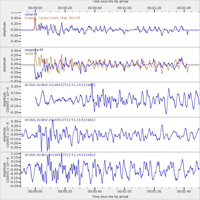
DUG Dugway, Tooele County, Utah, USA - Earthquake Result Viewer
*The percent match for this event was below the threshold and hence no stack was calculated.
| Earthquake location: |
Northern Mid-Atlantic Ridge |
| Earthquake latitude/longitude: |
45.0/-27.8 |
| Earthquake time(UTC): |
2014/05/23 (143) 23:41:49 GMT |
| Earthquake Depth: |
10 km |
| Earthquake Magnitude: |
5.5 MWC, 5.5 MWC |
| Earthquake Catalog/Contributor: |
NEIC PDE/NEIC COMCAT |
|
| Network: |
US United States National Seismic Network |
| Station: |
DUG Dugway, Tooele County, Utah, USA |
| Lat/Lon: |
40.19 N/112.81 W |
| Elevation: |
1477 m |
|
| Distance: |
59.9 deg |
| Az: |
298.163 deg |
| Baz: |
54.687 deg |
| Ray Param: |
$rayparam |
*The percent match for this event was below the threshold and hence was not used in the summary stack. |
|
| Radial Match: |
56.16471 % |
| Radial Bump: |
400 |
| Transverse Match: |
60.430454 % |
| Transverse Bump: |
400 |
| SOD ConfigId: |
626651 |
| Insert Time: |
2014-06-15 05:49:05.434 +0000 |
| GWidth: |
2.5 |
| Max Bumps: |
400 |
| Tol: |
0.001 |
|
Signal To Noise
| Channel | StoN | STA | LTA |
| US:DUG:00:BHZ:20140523T23:51:24.523982Z | 2.5604916 | 1.4053926E-7 | 5.4887607E-8 |
| US:DUG:00:BH1:20140523T23:51:24.523982Z | 1.7756003 | 5.9588512E-8 | 3.355964E-8 |
| US:DUG:00:BH2:20140523T23:51:24.523982Z | 1.3002633 | 6.0210816E-8 | 4.6306635E-8 |
| Arrivals |
| Ps | |
| PpPs | |
| PsPs/PpSs | |


