You are here: Home > Network List > UW - Pacific Northwest Regional Seismic Network Stations List
> Station PASS Maple Falls, WA, USA > Earthquake Result Viewer
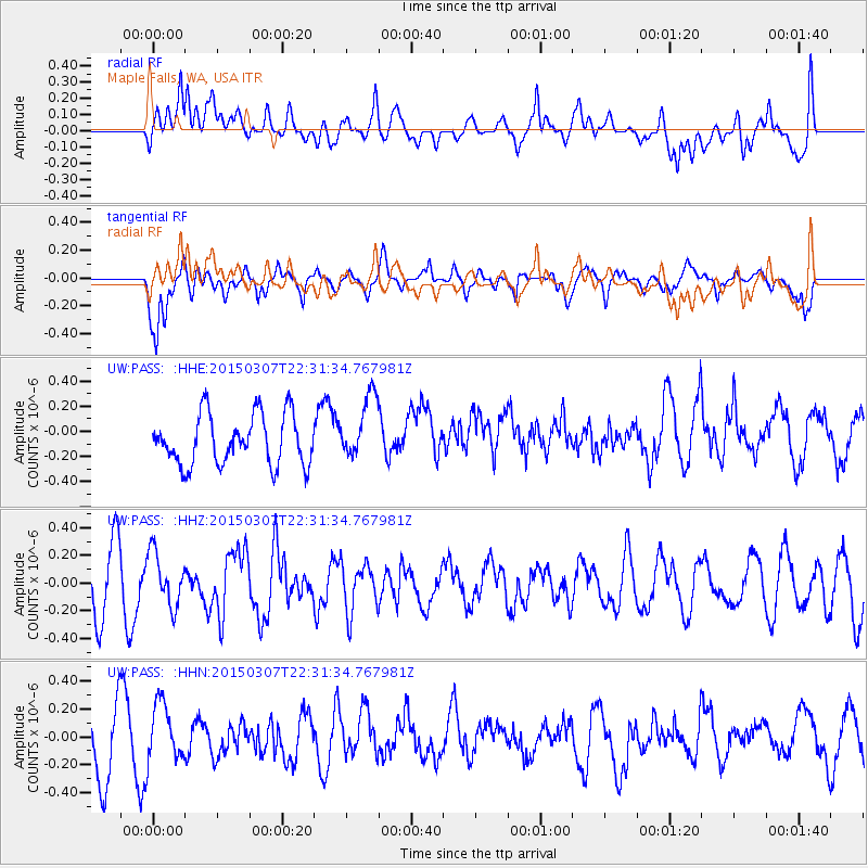
PASS Maple Falls, WA, USA - Earthquake Result Viewer
*The percent match for this event was below the threshold and hence no stack was calculated.
| Earthquake location: |
New Britain Region, P.N.G. |
| Earthquake latitude/longitude: |
-6.6/151.7 |
| Earthquake time(UTC): |
2015/03/07 (066) 22:18:58 GMT |
| Earthquake Depth: |
23 km |
| Earthquake Magnitude: |
6.0 MB |
| Earthquake Catalog/Contributor: |
NEIC PDE/NEIC COMCAT |
|
| Network: |
UW Pacific Northwest Regional Seismic Network |
| Station: |
PASS Maple Falls, WA, USA |
| Lat/Lon: |
49.00 N/122.09 W |
| Elevation: |
174 m |
|
| Distance: |
92.4 deg |
| Az: |
41.124 deg |
| Baz: |
262.844 deg |
| Ray Param: |
$rayparam |
*The percent match for this event was below the threshold and hence was not used in the summary stack. |
|
| Radial Match: |
57.095684 % |
| Radial Bump: |
400 |
| Transverse Match: |
63.849346 % |
| Transverse Bump: |
400 |
| SOD ConfigId: |
7019011 |
| Insert Time: |
2019-04-17 06:06:02.025 +0000 |
| GWidth: |
2.5 |
| Max Bumps: |
400 |
| Tol: |
0.001 |
|
Signal To Noise
| Channel | StoN | STA | LTA |
| UW:PASS: :HHZ:20150307T22:31:34.767981Z | 1.0810213 | 1.9171152E-7 | 1.7734295E-7 |
| UW:PASS: :HHN:20150307T22:31:34.767981Z | 1.0359486 | 2.0143905E-7 | 1.9444889E-7 |
| UW:PASS: :HHE:20150307T22:31:34.767981Z | 1.3226074 | 2.6374528E-7 | 1.9941312E-7 |
| Arrivals |
| Ps | |
| PpPs | |
| PsPs/PpSs | |


