ABKT Alibek, Turkmenistan - Earthquake Result Viewer
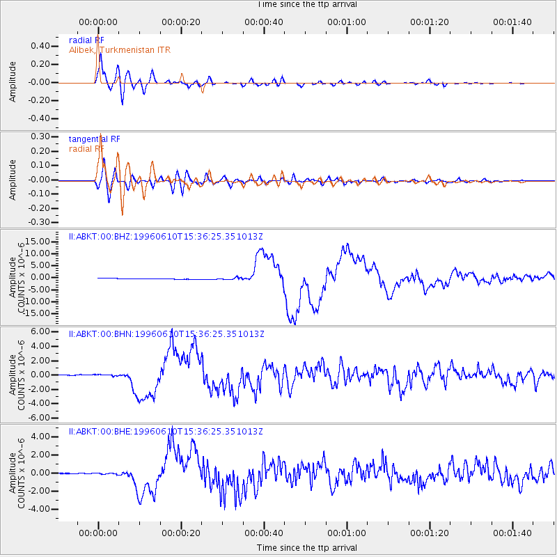
Earthquake location: Andreanof Islands, Aleutian Is.
Earthquake latitude/longitude: 51.5/-176.8
Earthquake time(UTC): 1996/06/10 (162) 15:24:56 GMT
Earthquake Depth: 26 km
Earthquake Magnitude: 5.9 MB, 7.1 MS, 7.2 UNKNOWN, 6.9 MS
Earthquake Catalog/Contributor: WHDF/NEIC
Network: II Global Seismograph Network (GSN - IRIS/IDA)
Station: ABKT Alibek, Turkmenistan
Lat/Lon: 37.93 N/58.12 E
Elevation: 678 m
Distance: 78.8 deg
Az: 318.701 deg
Baz: 31.464 deg
Ray Param: 0.049347304
Estimated Moho Depth: 12.5 km
Estimated Crust Vp/Vs: 1.60
Assumed Crust Vp: 6.53 km/s
Estimated Crust Vs: 4.082 km/s
Estimated Crust Poisson's Ratio: 0.18
Radial Match: 97.12721 %
Radial Bump: 400
Transverse Match: 86.44048 %
Transverse Bump: 400
SOD ConfigId: 6273
Insert Time: 2010-03-01 22:52:40.811 +0000
GWidth: 2.5
Max Bumps: 400
Tol: 0.001

Signal To Noise

ChannelStoNSTALTA
II:ABKT:00:BHN:19960610T15:36:25.351013Z2.22295521.02614074E-74.6161105E-8
II:ABKT:00:BHE:19960610T15:36:25.351013Z2.1126966.8516165E-83.243068E-8
II:ABKT:00:BHZ:19960610T15:36:25.351013Z2.55439193.9991264E-71.5655884E-7
Arrivals
Ps1.2 SECOND
PpPs4.8 SECOND
PsPs/PpSs6.0 SECOND