You are here: Home > Network List > TA - USArray Transportable Network (new EarthScope stations) Stations List
> Station D48A Paudash Township, ON, CAN > Earthquake Result Viewer
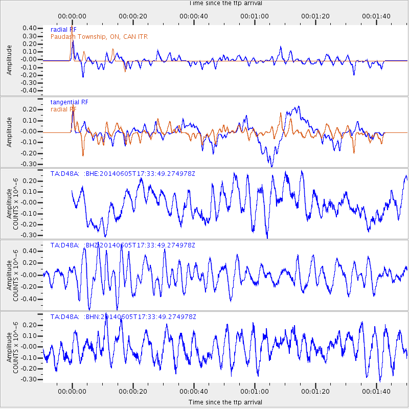
D48A Paudash Township, ON, CAN - Earthquake Result Viewer
*The percent match for this event was below the threshold and hence no stack was calculated.
| Earthquake location: |
Easter Island Region |
| Earthquake latitude/longitude: |
-28.9/-112.3 |
| Earthquake time(UTC): |
2014/06/05 (156) 17:22:07 GMT |
| Earthquake Depth: |
7.7 km |
| Earthquake Magnitude: |
5.7 MWB |
| Earthquake Catalog/Contributor: |
NEIC PDE/NEIC COMCAT |
|
| Network: |
TA USArray Transportable Network (new EarthScope stations) |
| Station: |
D48A Paudash Township, ON, CAN |
| Lat/Lon: |
47.17 N/81.81 W |
| Elevation: |
434 m |
|
| Distance: |
80.6 deg |
| Az: |
20.546 deg |
| Baz: |
206.814 deg |
| Ray Param: |
$rayparam |
*The percent match for this event was below the threshold and hence was not used in the summary stack. |
|
| Radial Match: |
61.417866 % |
| Radial Bump: |
400 |
| Transverse Match: |
26.351902 % |
| Transverse Bump: |
400 |
| SOD ConfigId: |
626651 |
| Insert Time: |
2014-06-19 17:55:10.867 +0000 |
| GWidth: |
2.5 |
| Max Bumps: |
400 |
| Tol: |
0.001 |
|
Signal To Noise
| Channel | StoN | STA | LTA |
| TA:D48A: :BHZ:20140605T17:33:49.274978Z | 2.8939147 | 2.4850314E-7 | 8.587093E-8 |
| TA:D48A: :BHN:20140605T17:33:49.274978Z | 1.0688686 | 1.0380542E-7 | 9.71171E-8 |
| TA:D48A: :BHE:20140605T17:33:49.274978Z | 0.6969575 | 9.3992995E-8 | 1.3486186E-7 |
| Arrivals |
| Ps | |
| PpPs | |
| PsPs/PpSs | |


