You are here: Home > Network List > TA - USArray Transportable Network (new EarthScope stations) Stations List
> Station J49A Marlette, MI, USA > Earthquake Result Viewer
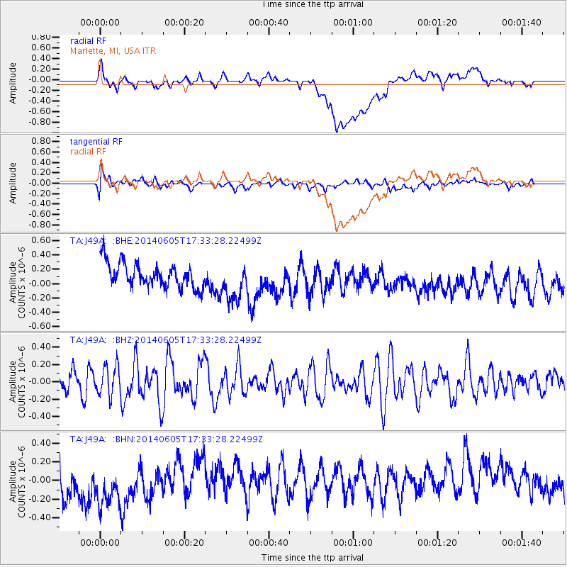
J49A Marlette, MI, USA - Earthquake Result Viewer
*The percent match for this event was below the threshold and hence no stack was calculated.
| Earthquake location: |
Easter Island Region |
| Earthquake latitude/longitude: |
-28.9/-112.3 |
| Earthquake time(UTC): |
2014/06/05 (156) 17:22:07 GMT |
| Earthquake Depth: |
7.7 km |
| Earthquake Magnitude: |
5.7 MWB |
| Earthquake Catalog/Contributor: |
NEIC PDE/NEIC COMCAT |
|
| Network: |
TA USArray Transportable Network (new EarthScope stations) |
| Station: |
J49A Marlette, MI, USA |
| Lat/Lon: |
43.36 N/83.14 W |
| Elevation: |
253 m |
|
| Distance: |
76.7 deg |
| Az: |
21.418 deg |
| Baz: |
206.042 deg |
| Ray Param: |
$rayparam |
*The percent match for this event was below the threshold and hence was not used in the summary stack. |
|
| Radial Match: |
40.995056 % |
| Radial Bump: |
400 |
| Transverse Match: |
52.311882 % |
| Transverse Bump: |
400 |
| SOD ConfigId: |
626651 |
| Insert Time: |
2014-06-19 17:57:19.591 +0000 |
| GWidth: |
2.5 |
| Max Bumps: |
400 |
| Tol: |
0.001 |
|
Signal To Noise
| Channel | StoN | STA | LTA |
| TA:J49A: :BHZ:20140605T17:33:28.22499Z | 1.0339216 | 1.7237159E-7 | 1.6671629E-7 |
| TA:J49A: :BHN:20140605T17:33:28.22499Z | 1.4738741 | 3.8455053E-7 | 2.6091138E-7 |
| TA:J49A: :BHE:20140605T17:33:28.22499Z | 1.5900351 | 2.7088538E-7 | 1.703644E-7 |
| Arrivals |
| Ps | |
| PpPs | |
| PsPs/PpSs | |


