You are here: Home > Network List > TA - USArray Transportable Network (new EarthScope stations) Stations List
> Station R59A King George, VA, USA > Earthquake Result Viewer
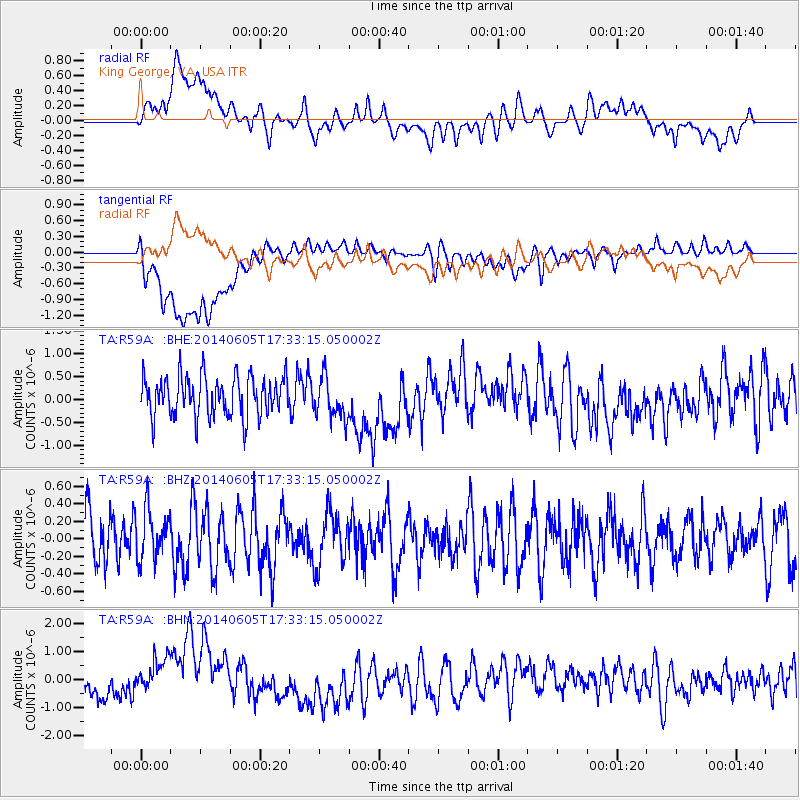
R59A King George, VA, USA - Earthquake Result Viewer
*The percent match for this event was below the threshold and hence no stack was calculated.
| Earthquake location: |
Easter Island Region |
| Earthquake latitude/longitude: |
-28.9/-112.3 |
| Earthquake time(UTC): |
2014/06/05 (156) 17:22:07 GMT |
| Earthquake Depth: |
7.7 km |
| Earthquake Magnitude: |
5.7 MWB |
| Earthquake Catalog/Contributor: |
NEIC PDE/NEIC COMCAT |
|
| Network: |
TA USArray Transportable Network (new EarthScope stations) |
| Station: |
R59A King George, VA, USA |
| Lat/Lon: |
38.20 N/77.12 W |
| Elevation: |
35 m |
|
| Distance: |
74.4 deg |
| Az: |
28.12 deg |
| Baz: |
211.638 deg |
| Ray Param: |
$rayparam |
*The percent match for this event was below the threshold and hence was not used in the summary stack. |
|
| Radial Match: |
47.85651 % |
| Radial Bump: |
400 |
| Transverse Match: |
51.241756 % |
| Transverse Bump: |
400 |
| SOD ConfigId: |
626651 |
| Insert Time: |
2014-06-19 18:00:23.846 +0000 |
| GWidth: |
2.5 |
| Max Bumps: |
400 |
| Tol: |
0.001 |
|
Signal To Noise
| Channel | StoN | STA | LTA |
| TA:R59A: :BHZ:20140605T17:33:15.050002Z | 0.9792709 | 2.8622222E-7 | 2.9228093E-7 |
| TA:R59A: :BHN:20140605T17:33:15.050002Z | 1.5037383 | 7.89688E-7 | 5.2514986E-7 |
| TA:R59A: :BHE:20140605T17:33:15.050002Z | 1.026551 | 4.526634E-7 | 4.4095555E-7 |
| Arrivals |
| Ps | |
| PpPs | |
| PsPs/PpSs | |


