You are here: Home > Network List > TA - USArray Transportable Network (new EarthScope stations) Stations List
> Station Y59A Loris, SC, USA > Earthquake Result Viewer
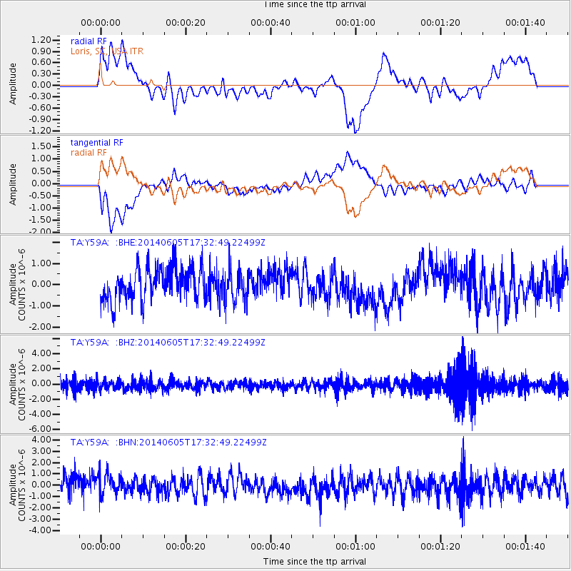
Y59A Loris, SC, USA - Earthquake Result Viewer
*The percent match for this event was below the threshold and hence no stack was calculated.
| Earthquake location: |
Easter Island Region |
| Earthquake latitude/longitude: |
-28.9/-112.3 |
| Earthquake time(UTC): |
2014/06/05 (156) 17:22:07 GMT |
| Earthquake Depth: |
7.7 km |
| Earthquake Magnitude: |
5.7 MWB |
| Earthquake Catalog/Contributor: |
NEIC PDE/NEIC COMCAT |
|
| Network: |
TA USArray Transportable Network (new EarthScope stations) |
| Station: |
Y59A Loris, SC, USA |
| Lat/Lon: |
33.99 N/78.87 W |
| Elevation: |
2.0 m |
|
| Distance: |
70.1 deg |
| Az: |
29.132 deg |
| Baz: |
210.916 deg |
| Ray Param: |
$rayparam |
*The percent match for this event was below the threshold and hence was not used in the summary stack. |
|
| Radial Match: |
35.269115 % |
| Radial Bump: |
400 |
| Transverse Match: |
60.649418 % |
| Transverse Bump: |
400 |
| SOD ConfigId: |
626651 |
| Insert Time: |
2014-06-19 18:02:36.880 +0000 |
| GWidth: |
2.5 |
| Max Bumps: |
400 |
| Tol: |
0.001 |
|
Signal To Noise
| Channel | StoN | STA | LTA |
| TA:Y59A: :BHZ:20140605T17:32:49.22499Z | 0.9324348 | 6.0138046E-7 | 6.4495714E-7 |
| TA:Y59A: :BHN:20140605T17:32:49.22499Z | 0.8825098 | 1.2973406E-6 | 1.470058E-6 |
| TA:Y59A: :BHE:20140605T17:32:49.22499Z | 0.95471597 | 7.4011086E-7 | 7.7521577E-7 |
| Arrivals |
| Ps | |
| PpPs | |
| PsPs/PpSs | |


