You are here: Home > Network List > US - United States National Seismic Network Stations List
> Station HAWA Hanford, Washington, USA > Earthquake Result Viewer
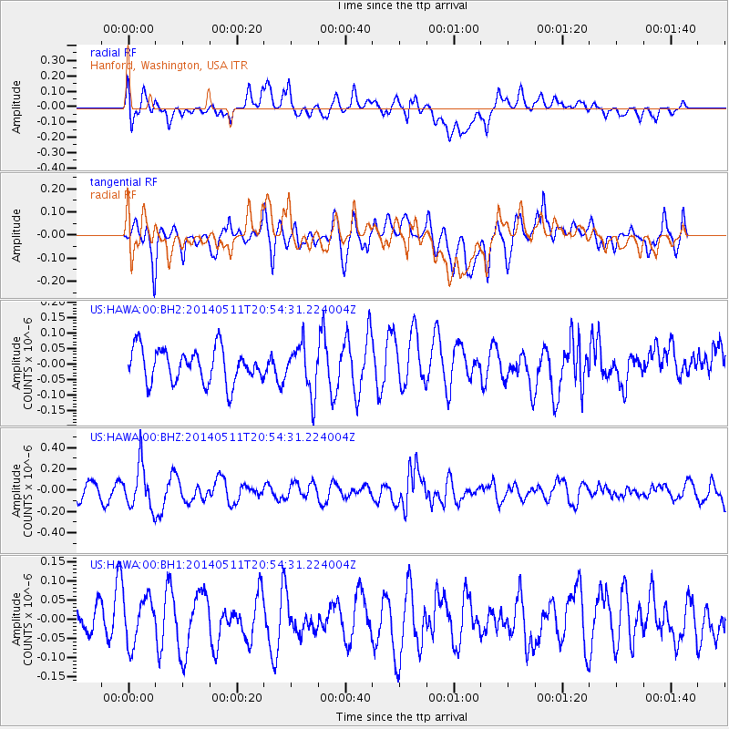
HAWA Hanford, Washington, USA - Earthquake Result Viewer
*The percent match for this event was below the threshold and hence no stack was calculated.
| Earthquake location: |
Vanuatu Islands |
| Earthquake latitude/longitude: |
-13.9/167.2 |
| Earthquake time(UTC): |
2014/05/11 (131) 20:42:30 GMT |
| Earthquake Depth: |
189 km |
| Earthquake Magnitude: |
5.6 MWW, 5.7 MWB, 5.7 MWC |
| Earthquake Catalog/Contributor: |
NEIC PDE/NEIC COMCAT |
|
| Network: |
US United States National Seismic Network |
| Station: |
HAWA Hanford, Washington, USA |
| Lat/Lon: |
46.39 N/119.53 W |
| Elevation: |
364 m |
|
| Distance: |
88.7 deg |
| Az: |
41.518 deg |
| Baz: |
248.446 deg |
| Ray Param: |
$rayparam |
*The percent match for this event was below the threshold and hence was not used in the summary stack. |
|
| Radial Match: |
44.614807 % |
| Radial Bump: |
400 |
| Transverse Match: |
50.57847 % |
| Transverse Bump: |
400 |
| SOD ConfigId: |
626651 |
| Insert Time: |
2014-06-20 21:21:08.183 +0000 |
| GWidth: |
2.5 |
| Max Bumps: |
400 |
| Tol: |
0.001 |
|
Signal To Noise
| Channel | StoN | STA | LTA |
| US:HAWA:00:BHZ:20140511T20:54:31.224004Z | 2.7617238 | 2.0681586E-7 | 7.4886515E-8 |
| US:HAWA:00:BH1:20140511T20:54:31.224004Z | 1.0859762 | 6.1380376E-8 | 5.6520914E-8 |
| US:HAWA:00:BH2:20140511T20:54:31.224004Z | 1.4381602 | 7.88403E-8 | 5.482025E-8 |
| Arrivals |
| Ps | |
| PpPs | |
| PsPs/PpSs | |


