You are here: Home > Network List > US - United States National Seismic Network Stations List
> Station MSO Missoula, Montana, USA > Earthquake Result Viewer
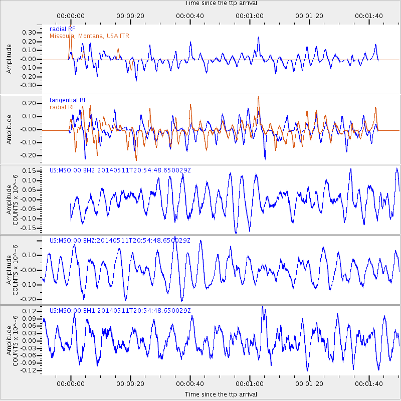
MSO Missoula, Montana, USA - Earthquake Result Viewer
*The percent match for this event was below the threshold and hence no stack was calculated.
| Earthquake location: |
Vanuatu Islands |
| Earthquake latitude/longitude: |
-13.9/167.2 |
| Earthquake time(UTC): |
2014/05/11 (131) 20:42:30 GMT |
| Earthquake Depth: |
189 km |
| Earthquake Magnitude: |
5.6 MWW, 5.7 MWB, 5.7 MWC |
| Earthquake Catalog/Contributor: |
NEIC PDE/NEIC COMCAT |
|
| Network: |
US United States National Seismic Network |
| Station: |
MSO Missoula, Montana, USA |
| Lat/Lon: |
46.83 N/113.94 W |
| Elevation: |
1264 m |
|
| Distance: |
92.5 deg |
| Az: |
42.395 deg |
| Baz: |
252.489 deg |
| Ray Param: |
$rayparam |
*The percent match for this event was below the threshold and hence was not used in the summary stack. |
|
| Radial Match: |
45.936817 % |
| Radial Bump: |
400 |
| Transverse Match: |
64.936905 % |
| Transverse Bump: |
400 |
| SOD ConfigId: |
626651 |
| Insert Time: |
2014-06-20 21:21:17.968 +0000 |
| GWidth: |
2.5 |
| Max Bumps: |
400 |
| Tol: |
0.001 |
|
Signal To Noise
| Channel | StoN | STA | LTA |
| US:MSO:00:BHZ:20140511T20:54:48.650029Z | 2.0508556 | 1.1592023E-7 | 5.6522858E-8 |
| US:MSO:00:BH1:20140511T20:54:48.650029Z | 1.2577434 | 5.581302E-8 | 4.437553E-8 |
| US:MSO:00:BH2:20140511T20:54:48.650029Z | 1.8408507 | 8.08473E-8 | 4.3918444E-8 |
| Arrivals |
| Ps | |
| PpPs | |
| PsPs/PpSs | |


