You are here: Home > Network List > UW - Pacific Northwest Regional Seismic Network Stations List
> Station UMAT Pilot Rock, OR, USA > Earthquake Result Viewer
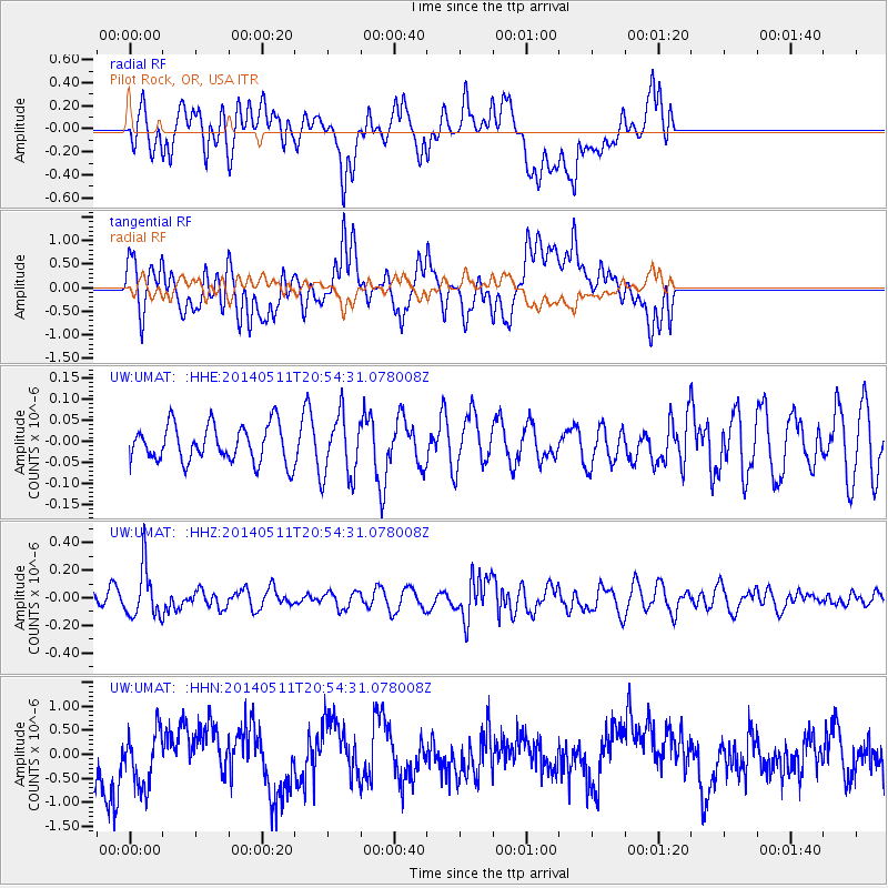
UMAT Pilot Rock, OR, USA - Earthquake Result Viewer
*The percent match for this event was below the threshold and hence no stack was calculated.
| Earthquake location: |
Vanuatu Islands |
| Earthquake latitude/longitude: |
-13.9/167.2 |
| Earthquake time(UTC): |
2014/05/11 (131) 20:42:30 GMT |
| Earthquake Depth: |
189 km |
| Earthquake Magnitude: |
5.6 MWW, 5.7 MWB, 5.7 MWC |
| Earthquake Catalog/Contributor: |
NEIC PDE/NEIC COMCAT |
|
| Network: |
UW Pacific Northwest Regional Seismic Network |
| Station: |
UMAT Pilot Rock, OR, USA |
| Lat/Lon: |
45.29 N/118.96 W |
| Elevation: |
1318 m |
|
| Distance: |
88.7 deg |
| Az: |
42.691 deg |
| Baz: |
248.882 deg |
| Ray Param: |
$rayparam |
*The percent match for this event was below the threshold and hence was not used in the summary stack. |
|
| Radial Match: |
33.52193 % |
| Radial Bump: |
400 |
| Transverse Match: |
34.51403 % |
| Transverse Bump: |
400 |
| SOD ConfigId: |
626651 |
| Insert Time: |
2014-06-20 21:23:21.447 +0000 |
| GWidth: |
2.5 |
| Max Bumps: |
400 |
| Tol: |
0.001 |
|
Signal To Noise
| Channel | StoN | STA | LTA |
| UW:UMAT: :HHZ:20140511T20:54:31.078008Z | 4.05347 | 1.7991307E-7 | 4.438495E-8 |
| UW:UMAT: :HHN:20140511T20:54:31.078008Z | 1.2521108 | 5.8542213E-7 | 4.6754818E-7 |
| UW:UMAT: :HHE:20140511T20:54:31.078008Z | 1.7256415 | 7.489345E-8 | 4.3400355E-8 |
| Arrivals |
| Ps | |
| PpPs | |
| PsPs/PpSs | |


