You are here: Home > Network List > UW - Pacific Northwest Regional Seismic Network Stations List
> Station UMAT Pilot Rock, OR, USA > Earthquake Result Viewer
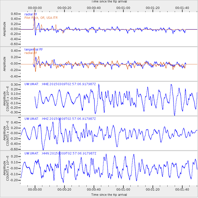
UMAT Pilot Rock, OR, USA - Earthquake Result Viewer
*The percent match for this event was below the threshold and hence no stack was calculated.
| Earthquake location: |
South Of Panama |
| Earthquake latitude/longitude: |
6.5/-82.7 |
| Earthquake time(UTC): |
2015/03/09 (068) 02:48:45 GMT |
| Earthquake Depth: |
10 km |
| Earthquake Magnitude: |
5.6 MO |
| Earthquake Catalog/Contributor: |
NEIC PDE/NEIC ALERT |
|
| Network: |
UW Pacific Northwest Regional Seismic Network |
| Station: |
UMAT Pilot Rock, OR, USA |
| Lat/Lon: |
45.29 N/118.96 W |
| Elevation: |
1318 m |
|
| Distance: |
49.8 deg |
| Az: |
326.843 deg |
| Baz: |
129.657 deg |
| Ray Param: |
$rayparam |
*The percent match for this event was below the threshold and hence was not used in the summary stack. |
|
| Radial Match: |
67.633415 % |
| Radial Bump: |
397 |
| Transverse Match: |
61.377453 % |
| Transverse Bump: |
400 |
| SOD ConfigId: |
7019011 |
| Insert Time: |
2019-04-17 06:31:00.822 +0000 |
| GWidth: |
2.5 |
| Max Bumps: |
400 |
| Tol: |
0.001 |
|
Signal To Noise
| Channel | StoN | STA | LTA |
| UW:UMAT: :HHZ:20150309T02:57:06.917987Z | 1.820495 | 2.2355316E-7 | 1.2279801E-7 |
| UW:UMAT: :HHN:20150309T02:57:06.917987Z | 0.800509 | 9.8027165E-8 | 1.2245606E-7 |
| UW:UMAT: :HHE:20150309T02:57:06.917987Z | 1.0976604 | 1.1222078E-7 | 1.02236335E-7 |
| Arrivals |
| Ps | |
| PpPs | |
| PsPs/PpSs | |


