ABKT Alibek, Turkmenistan - Earthquake Result Viewer
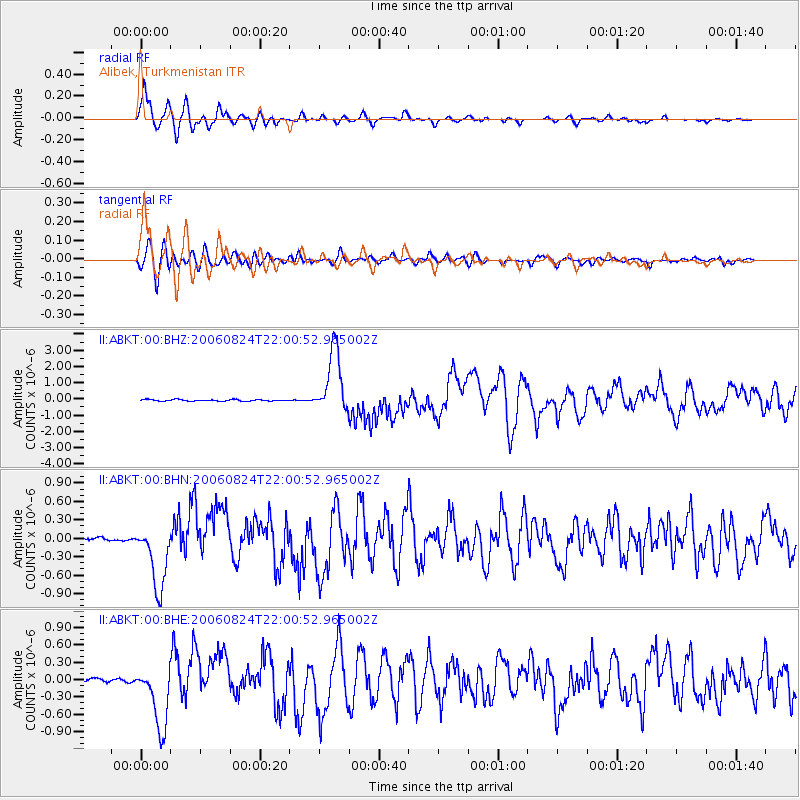
Earthquake location: Near East Coast Of Kamchatka
Earthquake latitude/longitude: 51.1/157.5
Earthquake time(UTC): 2006/08/24 (236) 21:50:36 GMT
Earthquake Depth: 43 km
Earthquake Magnitude: 5.9 MB, 6.2 MS, 6.5 MW, 6.5 MW
Earthquake Catalog/Contributor: WHDF/NEIC
Network: II Global Seismograph Network (GSN - IRIS/IDA)
Station: ABKT Alibek, Turkmenistan
Lat/Lon: 37.93 N/58.12 E
Elevation: 678 m
Distance: 66.8 deg
Az: 301.917 deg
Baz: 42.541 deg
Ray Param: 0.05729838
Estimated Moho Depth: 11.25 km
Estimated Crust Vp/Vs: 1.81
Assumed Crust Vp: 6.53 km/s
Estimated Crust Vs: 3.608 km/s
Estimated Crust Poisson's Ratio: 0.28
Radial Match: 95.77625 %
Radial Bump: 400
Transverse Match: 85.1278 %
Transverse Bump: 400
SOD ConfigId: 2564
Insert Time: 2010-03-01 22:54:52.968 +0000
GWidth: 2.5
Max Bumps: 400
Tol: 0.001

Signal To Noise

ChannelStoNSTALTA
II:ABKT:00:BHN:20060824T22:00:52.965002Z27.4809675.3574814E-71.9495245E-8
II:ABKT:00:BHE:20060824T22:00:52.965002Z25.7959465.57754E-72.162177E-8
II:ABKT:00:BHZ:20060824T22:00:52.965002Z41.9115681.948838E-64.6498812E-8
Arrivals
Ps1.5 SECOND
PpPs4.6 SECOND
PsPs/PpSs6.1 SECOND