
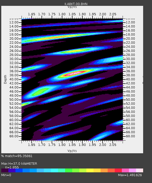
ABKT Alibek, Turkmenistan - Earthquake Result Viewer
| ||||||||||||||||||
| ||||||||||||||||||
| ||||||||||||||||||
|
Signal To Noise
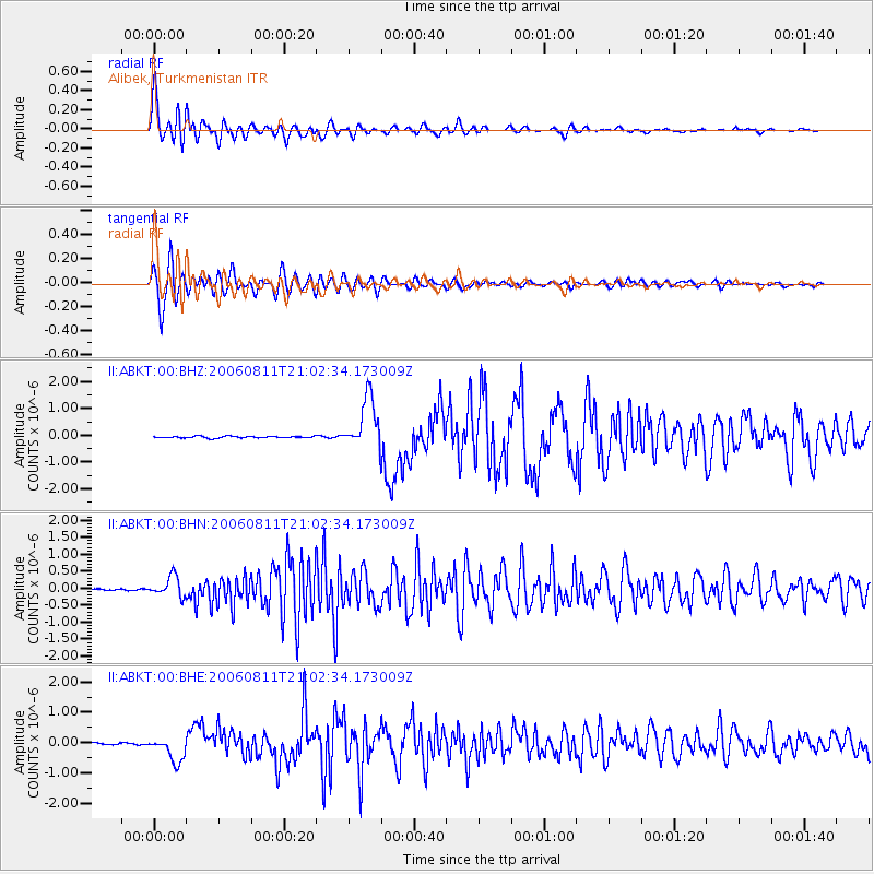
| Channel | StoN | STA | LTA |
| II:ABKT:00:BHN:20060811T21:02:34.173009Z | 11.195171 | 3.0031075E-7 | 2.6825022E-8 |
| II:ABKT:00:BHE:20060811T21:02:34.173009Z | 11.788138 | 4.177895E-7 | 3.5441516E-8 |
| II:ABKT:00:BHZ:20060811T21:02:34.173009Z | 28.672792 | 9.694926E-7 | 3.381228E-8 |
| Arrivals | |
| Ps | 5.1 SECOND |
| PpPs | 15 SECOND |
| PsPs/PpSs | 20 SECOND |

