
ABKT Alibek, Turkmenistan - Earthquake Result Viewer
| ||||||||||||||||||
| ||||||||||||||||||
| ||||||||||||||||||
|
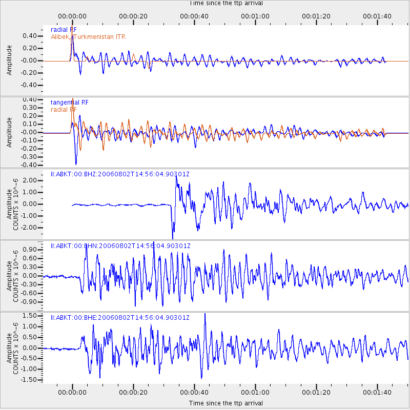
Signal To Noise
| Channel | StoN | STA | LTA |
| II:ABKT:00:BHN:20060802T14:56:04.90301Z | 15.233449 | 3.7669633E-7 | 2.4728237E-8 |
| II:ABKT:00:BHE:20060802T14:56:04.90301Z | 7.322353 | 2.2791906E-7 | 3.112648E-8 |
| II:ABKT:00:BHZ:20060802T14:56:04.90301Z | 25.337444 | 1.1754952E-6 | 4.63936E-8 |
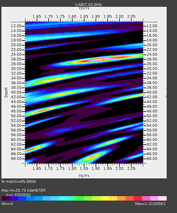
| Arrivals | |
| Ps | 3.8 SECOND |
| PpPs | 11 SECOND |
| PsPs/PpSs | 15 SECOND |

