ABKT Alibek, Turkmenistan - Earthquake Result Viewer
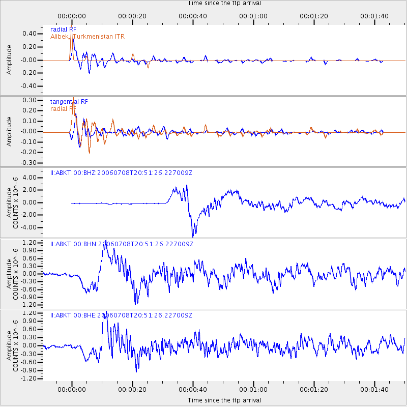
Earthquake location: Andreanof Islands, Aleutian Is.
Earthquake latitude/longitude: 51.2/-179.3
Earthquake time(UTC): 2006/07/08 (189) 20:40:00 GMT
Earthquake Depth: 22 km
Earthquake Magnitude: 6.2 MB, 6.4 MS, 6.6 MW, 6.6 MW
Earthquake Catalog/Contributor: WHDF/NEIC
Network: II Global Seismograph Network (GSN - IRIS/IDA)
Station: ABKT Alibek, Turkmenistan
Lat/Lon: 37.93 N/58.12 E
Elevation: 678 m
Distance: 78.0 deg
Az: 317.053 deg
Baz: 32.815 deg
Ray Param: 0.049926717
Estimated Moho Depth: 12.5 km
Estimated Crust Vp/Vs: 1.60
Assumed Crust Vp: 6.53 km/s
Estimated Crust Vs: 4.082 km/s
Estimated Crust Poisson's Ratio: 0.18
Radial Match: 96.3857 %
Radial Bump: 400
Transverse Match: 81.128716 %
Transverse Bump: 400
SOD ConfigId: 5423
Insert Time: 2010-03-01 22:55:52.567 +0000
GWidth: 2.5
Max Bumps: 400
Tol: 0.001

Signal To Noise

ChannelStoNSTALTA
II:ABKT:00:BHN:20060708T20:51:26.227009Z8.2454543.1615764E-73.834327E-8
II:ABKT:00:BHE:20060708T20:51:26.227009Z5.7034162.080378E-73.6476003E-8
II:ABKT:00:BHZ:20060708T20:51:26.227009Z28.8089491.2429496E-64.3144567E-8
Arrivals
Ps1.2 SECOND
PpPs4.8 SECOND
PsPs/PpSs6.0 SECOND