You are here: Home > Network List > TA - USArray Transportable Network (new EarthScope stations) Stations List
> Station Z41A Richland Creek Farm, El Dorado, AR, USA > Earthquake Result Viewer
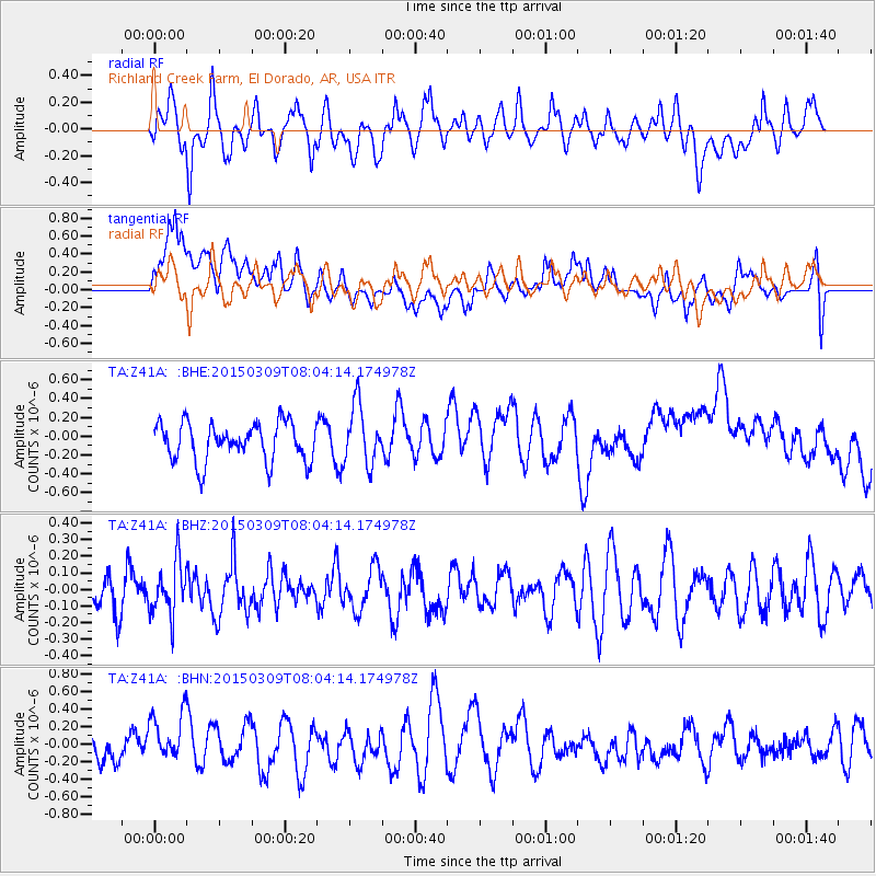
Z41A Richland Creek Farm, El Dorado, AR, USA - Earthquake Result Viewer
*The percent match for this event was below the threshold and hence no stack was calculated.
| Earthquake location: |
Off Coast Of Central Chile |
| Earthquake latitude/longitude: |
-34.3/-73.5 |
| Earthquake time(UTC): |
2015/03/09 (068) 07:53:35 GMT |
| Earthquake Depth: |
5.4 km |
| Earthquake Magnitude: |
4.9 MW |
| Earthquake Catalog/Contributor: |
ISC/ISC |
|
| Network: |
TA USArray Transportable Network (new EarthScope stations) |
| Station: |
Z41A Richland Creek Farm, El Dorado, AR, USA |
| Lat/Lon: |
33.26 N/92.80 W |
| Elevation: |
62 m |
|
| Distance: |
69.6 deg |
| Az: |
342.807 deg |
| Baz: |
163.024 deg |
| Ray Param: |
$rayparam |
*The percent match for this event was below the threshold and hence was not used in the summary stack. |
|
| Radial Match: |
52.37463 % |
| Radial Bump: |
400 |
| Transverse Match: |
33.568657 % |
| Transverse Bump: |
400 |
| SOD ConfigId: |
7019011 |
| Insert Time: |
2019-04-17 06:43:27.218 +0000 |
| GWidth: |
2.5 |
| Max Bumps: |
400 |
| Tol: |
0.001 |
|
Signal To Noise
| Channel | StoN | STA | LTA |
| TA:Z41A: :BHZ:20150309T08:04:14.174978Z | 1.3863329 | 1.5981149E-7 | 1.1527642E-7 |
| TA:Z41A: :BHN:20150309T08:04:14.174978Z | 1.4940157 | 2.8787622E-7 | 1.926862E-7 |
| TA:Z41A: :BHE:20150309T08:04:14.174978Z | 1.5465757 | 3.1438398E-7 | 2.0327745E-7 |
| Arrivals |
| Ps | |
| PpPs | |
| PsPs/PpSs | |


