You are here: Home > Network List > US - United States National Seismic Network Stations List
> Station DGMT Dagmar, Montana, USA > Earthquake Result Viewer
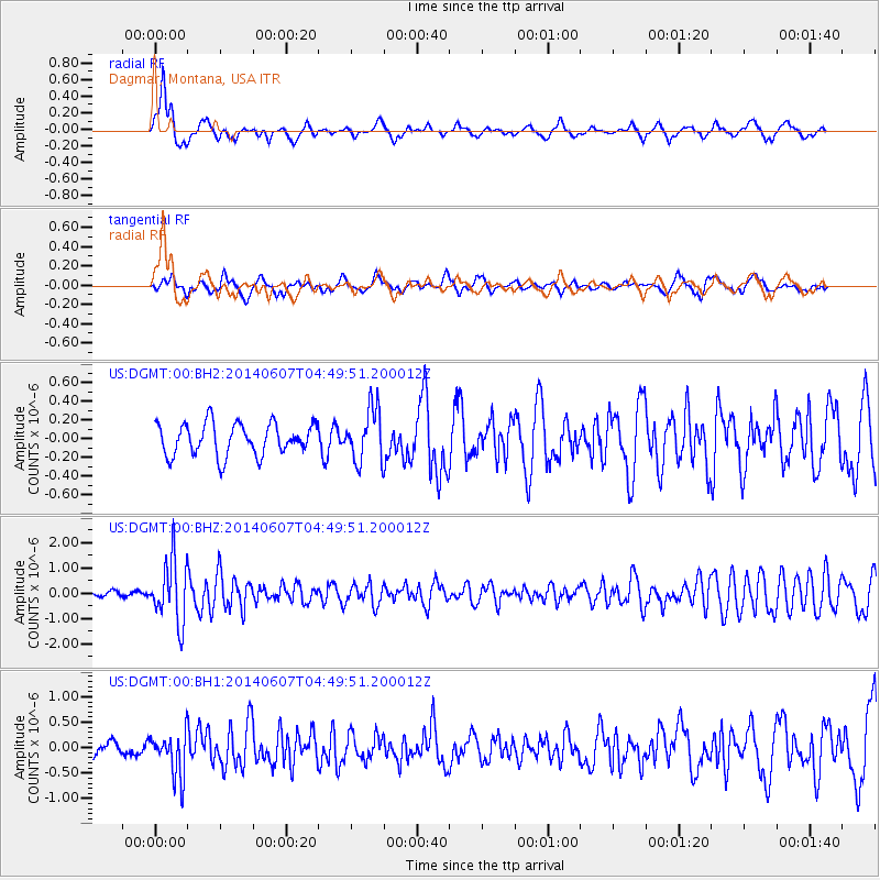
DGMT Dagmar, Montana, USA - Earthquake Result Viewer
*The percent match for this event was below the threshold and hence no stack was calculated.
| Earthquake location: |
Northern Alaska |
| Earthquake latitude/longitude: |
67.9/-162.4 |
| Earthquake time(UTC): |
2014/06/07 (158) 04:43:34 GMT |
| Earthquake Depth: |
14 km |
| Earthquake Magnitude: |
6.0 MI |
| Earthquake Catalog/Contributor: |
NEIC PDE/NEIC ALERT |
|
| Network: |
US United States National Seismic Network |
| Station: |
DGMT Dagmar, Montana, USA |
| Lat/Lon: |
48.47 N/104.20 W |
| Elevation: |
0.0 m |
|
| Distance: |
34.5 deg |
| Az: |
94.258 deg |
| Baz: |
325.428 deg |
| Ray Param: |
$rayparam |
*The percent match for this event was below the threshold and hence was not used in the summary stack. |
|
| Radial Match: |
73.17796 % |
| Radial Bump: |
400 |
| Transverse Match: |
66.31785 % |
| Transverse Bump: |
400 |
| SOD ConfigId: |
626651 |
| Insert Time: |
2014-06-21 05:52:43.507 +0000 |
| GWidth: |
2.5 |
| Max Bumps: |
400 |
| Tol: |
0.001 |
|
Signal To Noise
| Channel | StoN | STA | LTA |
| US:DGMT:00:BHZ:20140607T04:49:51.200012Z | 12.323568 | 1.2222825E-6 | 9.9182515E-8 |
| US:DGMT:00:BH1:20140607T04:49:51.200012Z | 2.4208057 | 4.2751864E-7 | 1.766018E-7 |
| US:DGMT:00:BH2:20140607T04:49:51.200012Z | 1.6821716 | 2.8429668E-7 | 1.6900576E-7 |
| Arrivals |
| Ps | |
| PpPs | |
| PsPs/PpSs | |


