ABKT Alibek, Turkmenistan - Earthquake Result Viewer
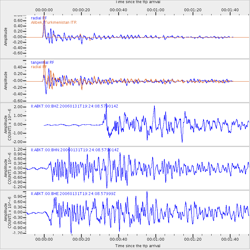
Earthquake location: Northern Sumatra, Indonesia
Earthquake latitude/longitude: 2.7/96.1
Earthquake time(UTC): 2006/01/31 (031) 19:15:51 GMT
Earthquake Depth: 20 km
Earthquake Magnitude: 5.7 MB, 5.5 MS, 5.9 MW, 5.9 MW
Earthquake Catalog/Contributor: WHDF/NEIC
Network: II Global Seismograph Network (GSN - IRIS/IDA)
Station: ABKT Alibek, Turkmenistan
Lat/Lon: 37.93 N/58.12 E
Elevation: 678 m
Distance: 49.3 deg
Az: 320.129 deg
Baz: 125.923 deg
Ray Param: 0.06873452
Estimated Moho Depth: 36.25 km
Estimated Crust Vp/Vs: 1.89
Assumed Crust Vp: 6.53 km/s
Estimated Crust Vs: 3.46 km/s
Estimated Crust Poisson's Ratio: 0.30
Radial Match: 94.42953 %
Radial Bump: 400
Transverse Match: 91.472206 %
Transverse Bump: 400
SOD ConfigId: 4977
Insert Time: 2010-03-01 22:57:01.231 +0000
GWidth: 2.5
Max Bumps: 400
Tol: 0.001

Signal To Noise

ChannelStoNSTALTA
II:ABKT:00:BHN:20060131T19:24:08.579014Z7.54394442.6564254E-73.5212686E-8
II:ABKT:00:BHE:20060131T19:24:08.57999Z5.1311162.7408086E-75.3415448E-8
II:ABKT:00:BHZ:20060131T19:24:08.579014Z15.9455697.332167E-74.5982475E-8
Arrivals
Ps5.2 SECOND
PpPs15 SECOND
PsPs/PpSs20 SECOND