ABKT Alibek, Turkmenistan - Earthquake Result Viewer
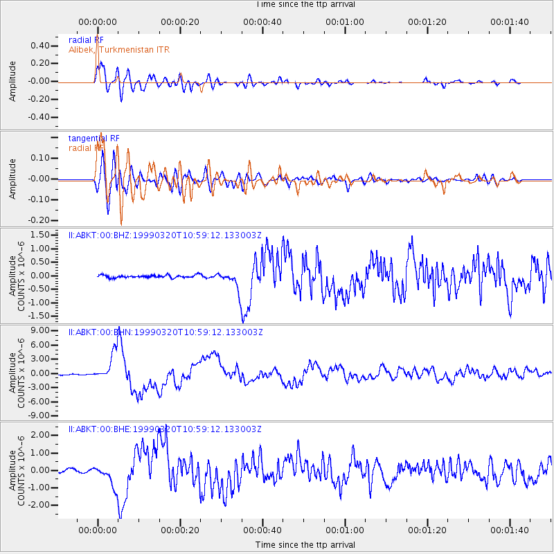
Earthquake location: Andreanof Islands, Aleutian Is.
Earthquake latitude/longitude: 51.6/-177.7
Earthquake time(UTC): 1999/03/20 (079) 10:47:45 GMT
Earthquake Depth: 33 km
Earthquake Magnitude: 6.3 MB, 6.8 MS, 6.9 MW, 6.8 ME
Earthquake Catalog/Contributor: WHDF/NEIC
Network: II Global Seismograph Network (GSN - IRIS/IDA)
Station: ABKT Alibek, Turkmenistan
Lat/Lon: 37.93 N/58.12 E
Elevation: 678 m
Distance: 78.4 deg
Az: 318.123 deg
Baz: 31.781 deg
Ray Param: 0.049618416
Estimated Moho Depth: 12.5 km
Estimated Crust Vp/Vs: 1.60
Assumed Crust Vp: 6.53 km/s
Estimated Crust Vs: 4.082 km/s
Estimated Crust Poisson's Ratio: 0.18
Radial Match: 94.429405 %
Radial Bump: 400
Transverse Match: 82.42795 %
Transverse Bump: 400
SOD ConfigId: 4480
Insert Time: 2010-03-01 22:57:35.311 +0000
GWidth: 2.5
Max Bumps: 400
Tol: 0.001

Signal To Noise

ChannelStoNSTALTA
II:ABKT:00:BHN:19990320T10:59:12.133003Z41.5308043.185602E-67.670456E-8
II:ABKT:00:BHE:19990320T10:59:12.133003Z7.90438276.6609283E-78.426879E-8
II:ABKT:00:BHZ:19990320T10:59:12.133003Z7.98668433.9247337E-74.9140965E-8
Arrivals
Ps1.2 SECOND
PpPs4.8 SECOND
PsPs/PpSs6.0 SECOND