You are here: Home > Network List > TA - USArray Transportable Network (new EarthScope stations) Stations List
> Station M47A Cromwell, IN, USA > Earthquake Result Viewer
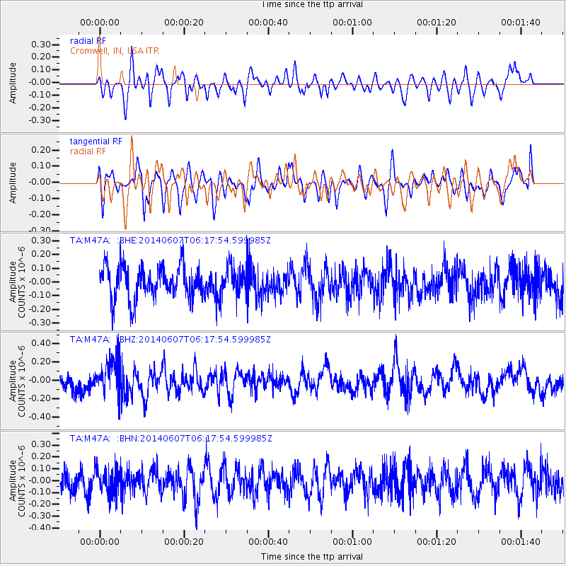
M47A Cromwell, IN, USA - Earthquake Result Viewer
*The percent match for this event was below the threshold and hence no stack was calculated.
| Earthquake location: |
Caspian Sea |
| Earthquake latitude/longitude: |
40.3/51.6 |
| Earthquake time(UTC): |
2014/06/07 (158) 06:05:27 GMT |
| Earthquake Depth: |
12 km |
| Earthquake Magnitude: |
5.5 MB |
| Earthquake Catalog/Contributor: |
NEIC PDE/NEIC COMCAT |
|
| Network: |
TA USArray Transportable Network (new EarthScope stations) |
| Station: |
M47A Cromwell, IN, USA |
| Lat/Lon: |
41.36 N/85.62 W |
| Elevation: |
283 m |
|
| Distance: |
89.9 deg |
| Az: |
329.242 deg |
| Baz: |
31.289 deg |
| Ray Param: |
$rayparam |
*The percent match for this event was below the threshold and hence was not used in the summary stack. |
|
| Radial Match: |
48.072666 % |
| Radial Bump: |
400 |
| Transverse Match: |
53.033684 % |
| Transverse Bump: |
400 |
| SOD ConfigId: |
626651 |
| Insert Time: |
2014-06-21 06:39:06.318 +0000 |
| GWidth: |
2.5 |
| Max Bumps: |
400 |
| Tol: |
0.001 |
|
Signal To Noise
| Channel | StoN | STA | LTA |
| TA:M47A: :BHZ:20140607T06:17:54.599985Z | 2.2481534 | 1.9577861E-7 | 8.708418E-8 |
| TA:M47A: :BHN:20140607T06:17:54.599985Z | 1.2848907 | 1.0955979E-7 | 8.526779E-8 |
| TA:M47A: :BHE:20140607T06:17:54.599985Z | 0.823421 | 9.890834E-8 | 1.2011878E-7 |
| Arrivals |
| Ps | |
| PpPs | |
| PsPs/PpSs | |


