You are here: Home > Network List > CI - Caltech Regional Seismic Network Stations List
> Station MPP McPhearson Peak > Earthquake Result Viewer
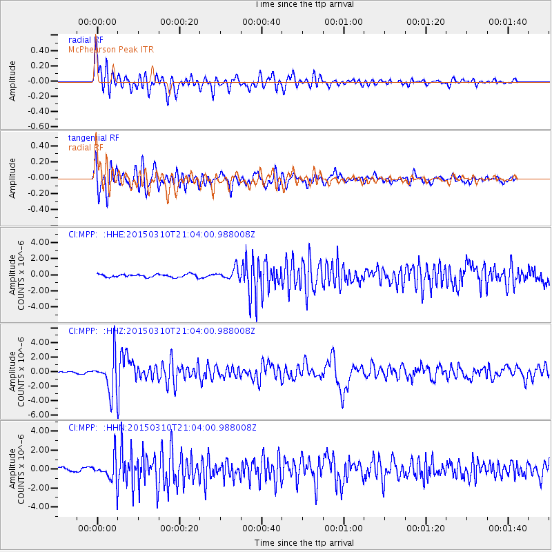
MPP McPhearson Peak - Earthquake Result Viewer
*The percent match for this event was below the threshold and hence no stack was calculated.
| Earthquake location: |
Northern Colombia |
| Earthquake latitude/longitude: |
6.8/-73.0 |
| Earthquake time(UTC): |
2015/03/10 (069) 20:55:43 GMT |
| Earthquake Depth: |
147 km |
| Earthquake Magnitude: |
6.2 MWB |
| Earthquake Catalog/Contributor: |
NEIC PDE/NEIC COMCAT |
|
| Network: |
CI Caltech Regional Seismic Network |
| Station: |
MPP McPhearson Peak |
| Lat/Lon: |
34.89 N/119.81 W |
| Elevation: |
1739 m |
|
| Distance: |
51.2 deg |
| Az: |
309.781 deg |
| Baz: |
111.829 deg |
| Ray Param: |
$rayparam |
*The percent match for this event was below the threshold and hence was not used in the summary stack. |
|
| Radial Match: |
86.23999 % |
| Radial Bump: |
400 |
| Transverse Match: |
78.491165 % |
| Transverse Bump: |
400 |
| SOD ConfigId: |
7019011 |
| Insert Time: |
2019-04-17 06:54:37.122 +0000 |
| GWidth: |
2.5 |
| Max Bumps: |
400 |
| Tol: |
0.001 |
|
Signal To Noise
| Channel | StoN | STA | LTA |
| CI:MPP: :HHZ:20150310T21:04:00.988008Z | 14.487004 | 2.519572E-6 | 1.7391946E-7 |
| CI:MPP: :HHN:20150310T21:04:00.988008Z | 4.1336823 | 1.2276377E-6 | 2.9698404E-7 |
| CI:MPP: :HHE:20150310T21:04:00.988008Z | 3.8768964 | 7.120744E-7 | 1.8367125E-7 |
| Arrivals |
| Ps | |
| PpPs | |
| PsPs/PpSs | |


