You are here: Home > Network List > TA - USArray Transportable Network (new EarthScope stations) Stations List
> Station A04D Lummi Island, WA, USA > Earthquake Result Viewer
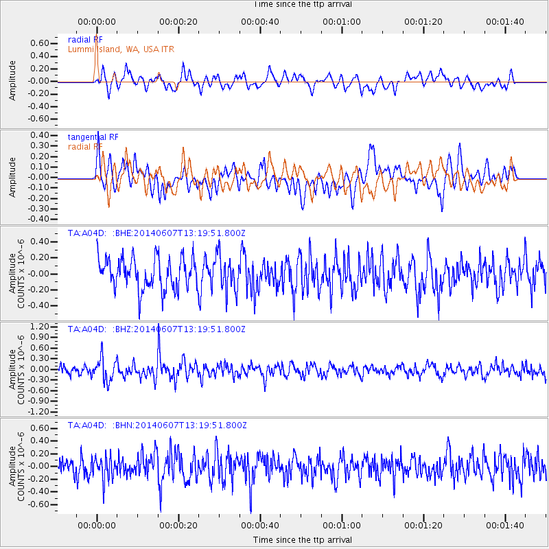
A04D Lummi Island, WA, USA - Earthquake Result Viewer
*The percent match for this event was below the threshold and hence no stack was calculated.
| Earthquake location: |
Kuril Islands |
| Earthquake latitude/longitude: |
50.7/157.1 |
| Earthquake time(UTC): |
2014/06/07 (158) 13:11:37 GMT |
| Earthquake Depth: |
56 km |
| Earthquake Magnitude: |
5.6 M |
| Earthquake Catalog/Contributor: |
NEIC PDE/NEIC ALERT |
|
| Network: |
TA USArray Transportable Network (new EarthScope stations) |
| Station: |
A04D Lummi Island, WA, USA |
| Lat/Lon: |
48.72 N/122.71 W |
| Elevation: |
13 m |
|
| Distance: |
49.4 deg |
| Az: |
59.184 deg |
| Baz: |
304.459 deg |
| Ray Param: |
$rayparam |
*The percent match for this event was below the threshold and hence was not used in the summary stack. |
|
| Radial Match: |
63.43108 % |
| Radial Bump: |
400 |
| Transverse Match: |
50.490303 % |
| Transverse Bump: |
400 |
| SOD ConfigId: |
626651 |
| Insert Time: |
2014-06-21 13:53:48.775 +0000 |
| GWidth: |
2.5 |
| Max Bumps: |
400 |
| Tol: |
0.001 |
|
Signal To Noise
| Channel | StoN | STA | LTA |
| TA:A04D: :BHZ:20140607T13:19:51.800Z | 3.3612125 | 3.2407345E-7 | 9.641564E-8 |
| TA:A04D: :BHN:20140607T13:19:51.800Z | 1.0546647 | 1.7849666E-7 | 1.6924493E-7 |
| TA:A04D: :BHE:20140607T13:19:51.800Z | 1.1413952 | 2.1901072E-7 | 1.9187982E-7 |
| Arrivals |
| Ps | |
| PpPs | |
| PsPs/PpSs | |


