You are here: Home > Network List > TA - USArray Transportable Network (new EarthScope stations) Stations List
> Station J49A Marlette, MI, USA > Earthquake Result Viewer
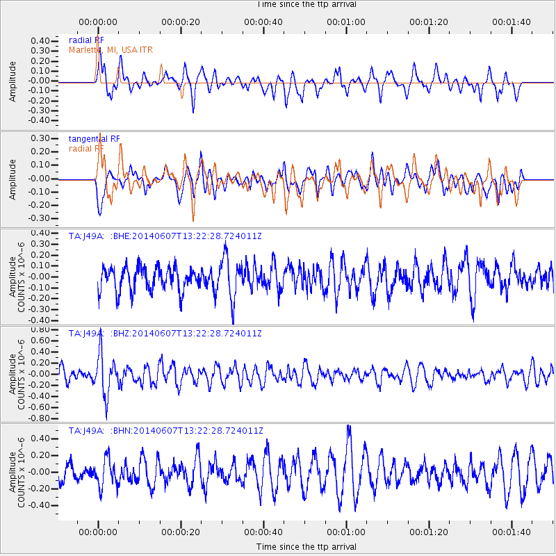
J49A Marlette, MI, USA - Earthquake Result Viewer
*The percent match for this event was below the threshold and hence no stack was calculated.
| Earthquake location: |
Kuril Islands |
| Earthquake latitude/longitude: |
50.7/157.1 |
| Earthquake time(UTC): |
2014/06/07 (158) 13:11:37 GMT |
| Earthquake Depth: |
56 km |
| Earthquake Magnitude: |
5.6 M |
| Earthquake Catalog/Contributor: |
NEIC PDE/NEIC ALERT |
|
| Network: |
TA USArray Transportable Network (new EarthScope stations) |
| Station: |
J49A Marlette, MI, USA |
| Lat/Lon: |
43.36 N/83.14 W |
| Elevation: |
253 m |
|
| Distance: |
72.7 deg |
| Az: |
41.556 deg |
| Baz: |
324.671 deg |
| Ray Param: |
$rayparam |
*The percent match for this event was below the threshold and hence was not used in the summary stack. |
|
| Radial Match: |
46.853798 % |
| Radial Bump: |
356 |
| Transverse Match: |
57.066387 % |
| Transverse Bump: |
400 |
| SOD ConfigId: |
626651 |
| Insert Time: |
2014-06-21 14:00:54.321 +0000 |
| GWidth: |
2.5 |
| Max Bumps: |
400 |
| Tol: |
0.001 |
|
Signal To Noise
| Channel | StoN | STA | LTA |
| TA:J49A: :BHZ:20140607T13:22:28.724011Z | 2.8058503 | 3.7005503E-7 | 1.3188695E-7 |
| TA:J49A: :BHN:20140607T13:22:28.724011Z | 1.6189178 | 1.6993026E-7 | 1.0496534E-7 |
| TA:J49A: :BHE:20140607T13:22:28.724011Z | 1.7974755 | 1.9152083E-7 | 1.06549905E-7 |
| Arrivals |
| Ps | |
| PpPs | |
| PsPs/PpSs | |


