You are here: Home > Network List > TA - USArray Transportable Network (new EarthScope stations) Stations List
> Station O03E Paynes Creek, CA, USA > Earthquake Result Viewer
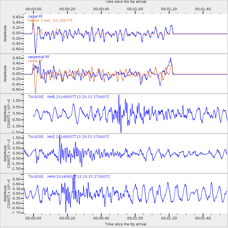
O03E Paynes Creek, CA, USA - Earthquake Result Viewer
*The percent match for this event was below the threshold and hence no stack was calculated.
| Earthquake location: |
Kuril Islands |
| Earthquake latitude/longitude: |
50.7/157.1 |
| Earthquake time(UTC): |
2014/06/07 (158) 13:11:37 GMT |
| Earthquake Depth: |
56 km |
| Earthquake Magnitude: |
5.6 M |
| Earthquake Catalog/Contributor: |
NEIC PDE/NEIC ALERT |
|
| Network: |
TA USArray Transportable Network (new EarthScope stations) |
| Station: |
O03E Paynes Creek, CA, USA |
| Lat/Lon: |
40.29 N/121.80 W |
| Elevation: |
967 m |
|
| Distance: |
55.1 deg |
| Az: |
67.17 deg |
| Baz: |
309.992 deg |
| Ray Param: |
$rayparam |
*The percent match for this event was below the threshold and hence was not used in the summary stack. |
|
| Radial Match: |
81.88117 % |
| Radial Bump: |
400 |
| Transverse Match: |
55.856785 % |
| Transverse Bump: |
400 |
| SOD ConfigId: |
626651 |
| Insert Time: |
2014-06-21 14:05:20.336 +0000 |
| GWidth: |
2.5 |
| Max Bumps: |
400 |
| Tol: |
0.001 |
|
Signal To Noise
| Channel | StoN | STA | LTA |
| TA:O03E: :HHZ:20140607T13:20:33.370007Z | 1.7499945 | 4.0032572E-7 | 2.2875828E-7 |
| TA:O03E: :HHN:20140607T13:20:33.370007Z | 1.1479478 | 3.0871388E-7 | 2.6892675E-7 |
| TA:O03E: :HHE:20140607T13:20:33.370007Z | 0.8844319 | 2.5824497E-7 | 2.9198966E-7 |
| Arrivals |
| Ps | |
| PpPs | |
| PsPs/PpSs | |


