You are here: Home > Network List > TA - USArray Transportable Network (new EarthScope stations) Stations List
> Station K49A Clarkson, MI, USA > Earthquake Result Viewer
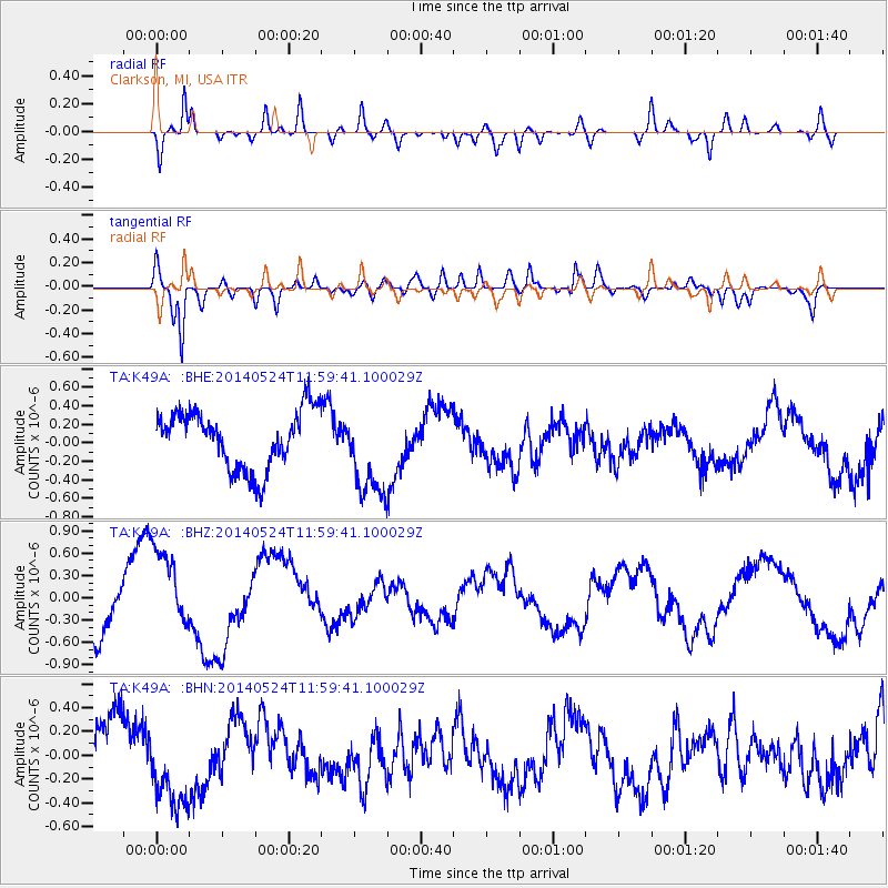
K49A Clarkson, MI, USA - Earthquake Result Viewer
*The percent match for this event was below the threshold and hence no stack was calculated.
| Earthquake location: |
Central Mid-Atlantic Ridge |
| Earthquake latitude/longitude: |
0.7/-26.3 |
| Earthquake time(UTC): |
2014/05/24 (144) 11:49:26 GMT |
| Earthquake Depth: |
10 km |
| Earthquake Magnitude: |
5.9 MWC, 5.9 MWC |
| Earthquake Catalog/Contributor: |
NEIC PDE/NEIC COMCAT |
|
| Network: |
TA USArray Transportable Network (new EarthScope stations) |
| Station: |
K49A Clarkson, MI, USA |
| Lat/Lon: |
42.78 N/83.46 W |
| Elevation: |
336 m |
|
| Distance: |
65.9 deg |
| Az: |
317.379 deg |
| Baz: |
113.115 deg |
| Ray Param: |
$rayparam |
*The percent match for this event was below the threshold and hence was not used in the summary stack. |
|
| Radial Match: |
79.12121 % |
| Radial Bump: |
400 |
| Transverse Match: |
78.632095 % |
| Transverse Bump: |
400 |
| SOD ConfigId: |
626651 |
| Insert Time: |
2014-06-22 07:28:53.311 +0000 |
| GWidth: |
2.5 |
| Max Bumps: |
400 |
| Tol: |
0.001 |
|
Signal To Noise
| Channel | StoN | STA | LTA |
| TA:K49A: :BHZ:20140524T11:59:41.100029Z | 1.8114661 | 5.756603E-7 | 3.1778697E-7 |
| TA:K49A: :BHN:20140524T11:59:41.100029Z | 1.4156834 | 3.4805427E-7 | 2.45856E-7 |
| TA:K49A: :BHE:20140524T11:59:41.100029Z | 1.5770113 | 4.917777E-7 | 3.1184157E-7 |
| Arrivals |
| Ps | |
| PpPs | |
| PsPs/PpSs | |


