You are here: Home > Network List > TA - USArray Transportable Network (new EarthScope stations) Stations List
> Station K62A Royalston, MA, USA > Earthquake Result Viewer
K62A Royalston, MA, USA - Earthquake Result Viewer

| Earthquake location: |
Northern Colombia |
| Earthquake latitude/longitude: |
6.8/-73.0 |
| Earthquake time(UTC): |
2015/03/10 (069) 20:55:43 GMT |
| Earthquake Depth: |
147 km |
| Earthquake Magnitude: |
6.2 MWB |
| Earthquake Catalog/Contributor: |
NEIC PDE/NEIC COMCAT |
|
| Network: |
TA USArray Transportable Network (new EarthScope stations) |
| Station: |
K62A Royalston, MA, USA |
| Lat/Lon: |
42.67 N/72.23 W |
| Elevation: |
289 m |
|
| Distance: |
35.7 deg |
| Az: |
0.982 deg |
| Baz: |
181.322 deg |
| Ray Param: |
0.07656891 |
| Estimated Moho Depth: |
19.5 km |
| Estimated Crust Vp/Vs: |
2.10 |
| Assumed Crust Vp: |
6.419 km/s |
| Estimated Crust Vs: |
3.06 km/s |
| Estimated Crust Poisson's Ratio: |
0.35 |
|
| Radial Match: |
90.33876 % |
| Radial Bump: |
211 |
| Transverse Match: |
74.12121 % |
| Transverse Bump: |
400 |
| SOD ConfigId: |
7019011 |
| Insert Time: |
2019-04-17 07:01:52.904 +0000 |
| GWidth: |
2.5 |
| Max Bumps: |
400 |
| Tol: |
0.001 |
|
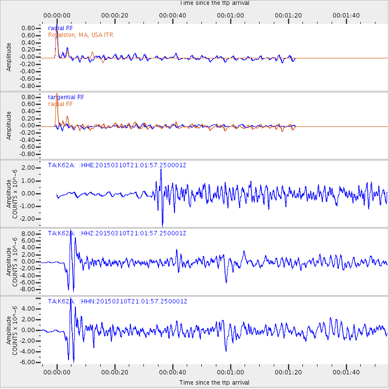
Signal To Noise
| Channel | StoN | STA | LTA |
| TA:K62A: :HHZ:20150310T21:01:57.250001Z | 27.558979 | 3.003054E-6 | 1.0896826E-7 |
| TA:K62A: :HHN:20150310T21:01:57.250001Z | 17.086018 | 2.0140158E-6 | 1.1787508E-7 |
| TA:K62A: :HHE:20150310T21:01:57.250001Z | 2.3443353 | 2.54959E-7 | 1.0875534E-7 |
| Arrivals |
| Ps | 3.5 SECOND |
| PpPs | 8.8 SECOND |
| PsPs/PpSs | 12 SECOND |


