You are here: Home > Network List > TA - USArray Transportable Network (new EarthScope stations) Stations List
> Station Q61A Milford, DE, USA > Earthquake Result Viewer
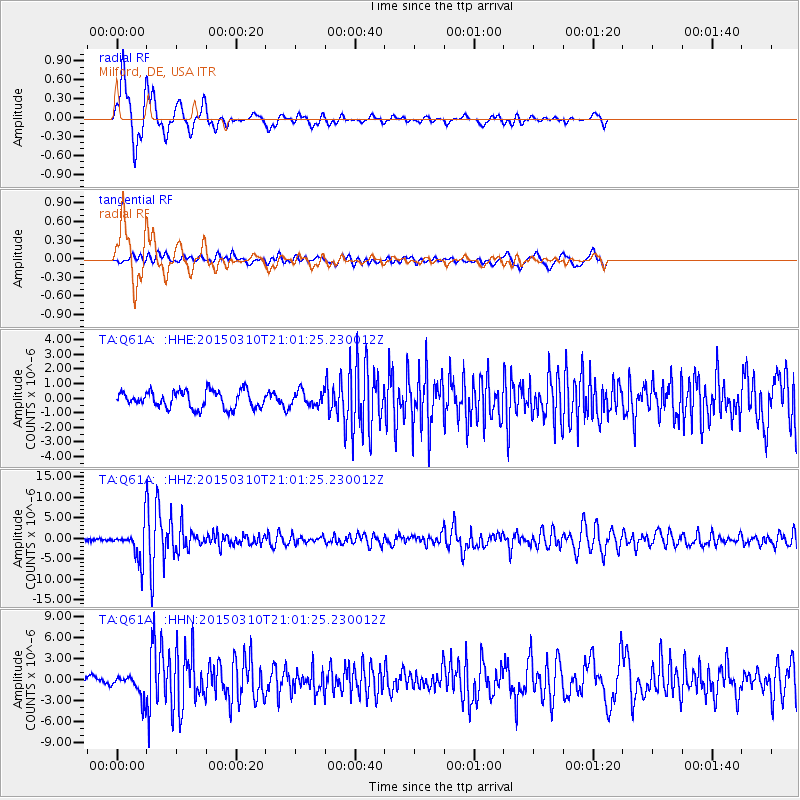
Q61A Milford, DE, USA - Earthquake Result Viewer
*The percent match for this event was below the threshold and hence no stack was calculated.
| Earthquake location: |
Northern Colombia |
| Earthquake latitude/longitude: |
6.8/-73.0 |
| Earthquake time(UTC): |
2015/03/10 (069) 20:55:43 GMT |
| Earthquake Depth: |
147 km |
| Earthquake Magnitude: |
6.2 MWB |
| Earthquake Catalog/Contributor: |
NEIC PDE/NEIC COMCAT |
|
| Network: |
TA USArray Transportable Network (new EarthScope stations) |
| Station: |
Q61A Milford, DE, USA |
| Lat/Lon: |
38.88 N/75.33 W |
| Elevation: |
5.0 m |
|
| Distance: |
32.0 deg |
| Az: |
356.588 deg |
| Baz: |
175.658 deg |
| Ray Param: |
$rayparam |
*The percent match for this event was below the threshold and hence was not used in the summary stack. |
|
| Radial Match: |
76.98159 % |
| Radial Bump: |
400 |
| Transverse Match: |
55.364754 % |
| Transverse Bump: |
400 |
| SOD ConfigId: |
7019011 |
| Insert Time: |
2019-04-17 07:02:50.214 +0000 |
| GWidth: |
2.5 |
| Max Bumps: |
400 |
| Tol: |
0.001 |
|
Signal To Noise
| Channel | StoN | STA | LTA |
| TA:Q61A: :HHZ:20150310T21:01:25.230012Z | 13.484631 | 3.9074303E-6 | 2.8976916E-7 |
| TA:Q61A: :HHN:20150310T21:01:25.230012Z | 2.2591798 | 1.6308386E-6 | 7.21872E-7 |
| TA:Q61A: :HHE:20150310T21:01:25.230012Z | 0.8596622 | 4.997966E-7 | 5.813872E-7 |
| Arrivals |
| Ps | |
| PpPs | |
| PsPs/PpSs | |


